







On the Weather Radar: Cloudy With a Chance of Birds

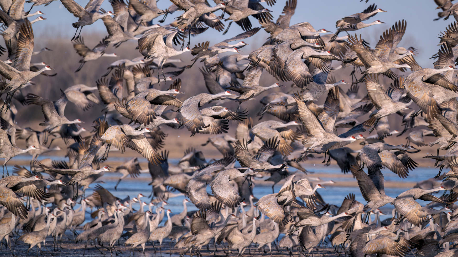
Migratory birds take flight, sometimes by the billions, under the cover of night, guided by celestial cues. Many depart just after dusk, timing their flight to coincide with rising atmospheric pressure, a sign of fair weather. Other species base their departure on the shift in daylight hours. They migrate because the seasons change, and the availability of resources shifts. But there are so many birds, and so many different types — more than 450 migratory species in North America alone — that observing and measuring their dynamic, complex migration over time presents major technical challenges.

For hundreds of years, naturalists and scientists tried to model this massive migration bird by bird. That approach only captured a fraction of the whole. “When we try to track individuals, in terms of putting devices on them, we’re really limited to tens to hundreds of birds being tracked when in fact there’s billions of birds migrating across the globe,” said Kyle Horton, a birder and researcher at Purdue University. “And so, trying to actually quantify the magnitude is really, really hard.”
Dedicated observers can and do list birds that they see or hear, but in more recent years they’ve turned to weather radar, which covers a third of the continental United States, constantly observing the skies day and night.
This year’s spring migration in North America unveiled real-time measures at a higher resolution than ever before. Take a snapshot of a single night: On April 15, 2026, around midnight, 156 million birds appeared in the skies above the continental U.S., outpacing the forecasted total by 20 million. And researchers figured that out thanks to artificial intelligence that can extract the birds out of public weather data.
Radar uses electromagnetic waves to track objects over distances, including aircraft and weather formations. For much of its existence, radar has been clouded by what is known as bioscatter, or what amounts to extraneous biological noise: birds, bats, and flying insects. British researchers dubbed these puzzling phantom-like appearances “angels.” Initially, repurposing these data — for studying birds and airborne organisms — hit hard limits.
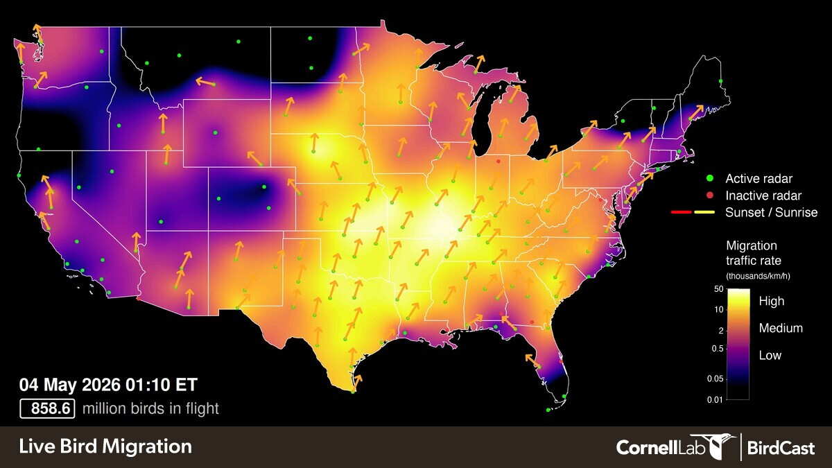
Part of the problem was mathematical: Humans could not analyze 15,000 radar images per night to remove the non-avian clutter and associate atmospheric variables with migration intensity. Over the last decade or so, machine learning algorithms essentially solved the problems. The observations and archived radar data, in turn, led to better migration forecasts.
Earlier this year, researchers from Purdue, including Horton, and collaborators from Cornell University, the University of Massachusetts Amherst, and the University of Illinois Urbana-Champaign released an update on BirdCast, a project that first started 26 years ago. It’s a reflection on the field of radar ornithology, which has not only come of age, but has fully fledged out under the more encompassing term of aeroecology, which refers to all the organisms that occupy the airspace. Without machine learning, Horton said, the detailed migration forecasts simply would not be possible: “BirdCast exists because we have artificial intelligence.”
The off-label applications of meteorological data also serve as a testament to public investment in a national surveillance network — namely, research from the National Oceanic and Atmospheric Administration — at a time when the current administration was pulling funds from federal agencies as part of broader cuts to science.
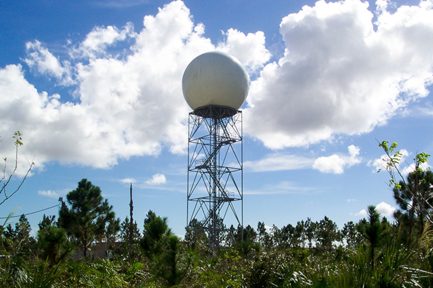
In the early 1990s, the National Weather Service began installing large white fiberglass domes, known as Weather Surveillance Doppler Radar, WSR-88D, or NEXRAD. It wasn’t long after the weather balls, as the domes are sometimes called, went live that Sidney Gauthreaux, an ornithologist then at Clemson University, envisioned using them to surveil avian migration. Andrew Farnsworth, one of Gauthreaux’s former graduate students who is now at Cornell Lab of Ornithology, said the work “opened people’s eyes to like, ‘Whoa, this is a major monitoring technology.’”
The first iteration of BirdCast launched in 2000, after receiving funding from the Environmental Protection Agency. (“They’re not doing that today,” Farnsworth said.) The group’s initial computation was relatively basic and relied on a set of equations. “We had two spreadsheets for the first BirdCast project,” Farnsworth said. Similarly, their focus was relatively narrow between North Carolina and New England. Each morning, the team would get data from 10 weather radar stations in the so-called mid-Atlantic flyway and input them into their spreadsheet, which would produce a number that was used to write the forecast. “It was just a linear equation,” said Farnsworth. “It’s like whether migration intensity relates to certain weather variables.”
It did. The work demonstrated that temperature is the biggest predictor of migration intensity. But after about a year, BirdCast 1.0 sputtered out.
One obstacle involved accessibility. Well into the 21st century, NOAA stored public radar data on ancient 8 mm magnetic Exabyte tapes. Dan Sheldon, a computer scientist at UMass-Amherst, said, “You had to place an order on a website, some robotic system that loaded tapes onto disks, they send you emails, you could download them.” (It wasn’t until 2015 that Amazon Web Services, the commercial cloud computing provider, addressed these problems.)
The group had another critical bottleneck: human vision. A radar image serves as a map, showing what objects reflect the beam back to the sensor; the brightness/intensity correlates with the object’s density — be it a cloud of water vapor or a flock of flying animals. But researchers had to actually look at radar signals and determine what pixelated chunks of green likely reflected birds and what reflected clouds.
Sheldon began building software, automating the steps involved in analyzing radar data with machine learning. In technical terms, the data contained information about radial velocity — whether an object was moving toward or away from the weather ball, and how quickly. Using many radial velocity measurements in different directions, they could reconstruct the velocity of objects, both direction and speed.
“BirdCast exists because we have artificial intelligence.”
But these data contained distortions, which meant they had two problems: removing the distortions, and reconstructing the velocity. Rather than solve them independently, one after the other, Sheldon and his colleagues’ algorithm made these inferences simultaneously. Jeff Buler, who runs the aeroecology program at the University of Delaware and has collaborated with several BirdCast authors, said it was a big deal in terms of figuring out velocity, but it was also something of a coup because, as he put it, “it took the ornithologists to come up with a better algorithm to recover radial velocities in the radar data than the meteorologists.” What followed was a sequence of papers that progressively scaled up until the ornithologists were doing what Gauthreaux originally envisioned, capturing bird density and migration intensity on a scale of the continental U.S. “The next big computational breakthrough was the MistNet paper,” Sheldon said. In 2019, MistNet stripped the precipitation out of the signal, leaving only the living organisms in the data. Horton, the Purdue researcher who was then a post-doc student at the Cornell Lab of Ornithology, said he used to look at hundreds of thousands of images, excluding the meteorological, including the biology. “Now it’s automated,” he added.
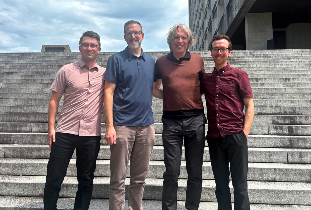
The BirdCast scientific team gathered at a conference earlier this year. From left to right: Kyle Horton, Daniel Sheldon, Adriaan Dokter, and Benjamin Van Doren.
Visual: Courtesy of Adriaan Dokter
In 2018, a group led by Adriaan Dokter, an ecologist with a physics background who now leads BirdCast at Cornell, released bioRad, an open-source tool to extract biological signals from weather radar data. Buler said bioRad facilitated communication across labs. “So not just building the algorithms to process the data,” he said, “but coming up with these standard metrics that we’re all now using.”
The software itself was the significant milestone, Buler said: “This might actually have more impact on the science than the publications will, per se.”
The fundamental questions had not changed; the ability to compute had. BirdCast relaunched and, Farnsworth said, the forecasts emerged as a direct result of publicly available data, machine learning, and the ability to process large amounts of data quickly. They could exclude meteorological data and isolate the biological. “All of this led to basically operationalizing in close to real time the analysis of the radar data that you see in the dashboard.”
It wasn’t just the radar data; the archived data informed the predictions, he added: “Both of those things came about as a result of the big data, cloud computing, machine learning age.”
About 10 years ago, around the time BirdCast 2.0 became fully operational, the North American Ornithological Conference held its annual meeting in Washington, D.C. Buler was scheduled to present research on 16 radars, and his presentation followed a group from Cornell that had identified a pattern suggesting higher concentrations of birds in urban areas. The researchers weren’t sure why the birds would seek urban areas during migration, or whether it was an anomaly in the data due to a higher concentration of birders in those locations.
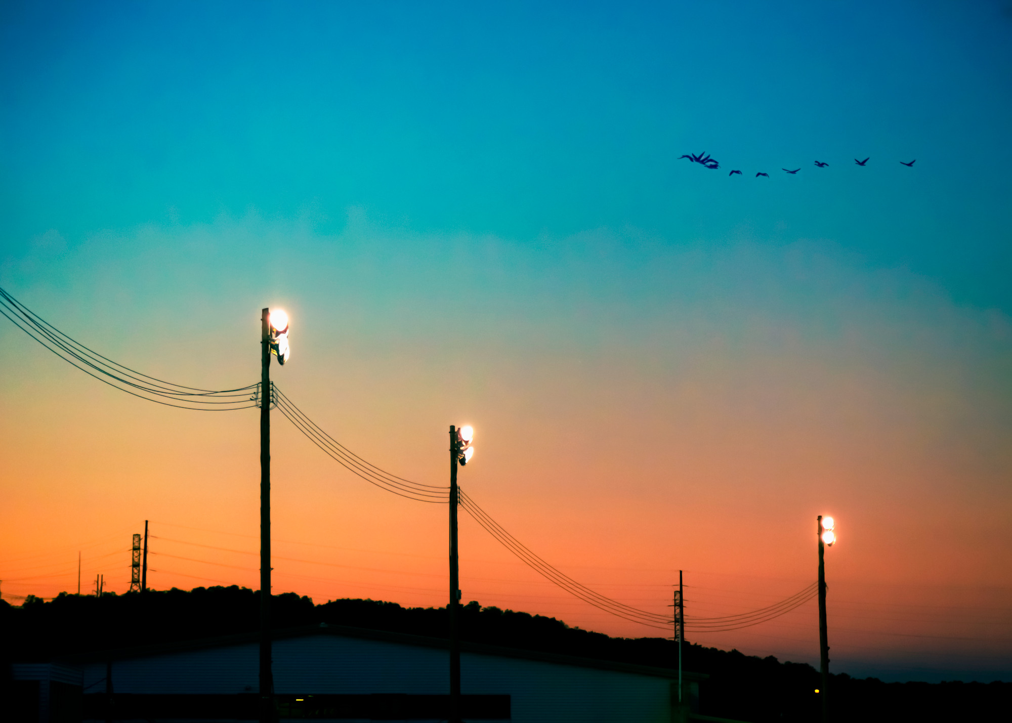
Buler thought he had the answer, and told them: “The birds are being drawn to light pollution.” The analysis of large-scale radar data revealed the phenomenon, and, as Buler remembered it, the Cornell group told him they’d never thought about that possibility. He recalls that he could practically see the light bulb going off over their heads.
The findings showed how bespoke AI models can be directed towards well-defined problems to get past key hurdles and barriers. “I think that is a very successful model for applying AI in science,” Sheldon said. “It’s a bit different from what you might imagine, which is like turning AI agents loose on a scientific problem and letting them solve it all on their own from the ideation phase, forming hypotheses, running experiments, drawing conclusions.”
It wasn’t so much that artificial intelligence autonomously made a discovery — a model had not been set loose to generate ecological hypotheses — but rather, the ability to process data at scale allowed human researchers to quantify ecological patterns, according to Buler. More recently, a group that included Horton found that across the Midwest, radar data showed that birds congregate around the edges of 90-plus million acres of intensely farmed land, almost as if it were a natural barrier like the Gulf of Mexico. (Birds appear to prefer forested routes, which provide stopovers to rest, refuel, and recover.) Without computational algorithms, the scientists wouldn’t have been able to see the pattern, Buler said, and “we’re now able to ask different research questions now that we can leverage that data set for ecology that we weren’t able to ask before.”
But the applications of AI to ecology have not arrived without criticism. In one recent paper, “Algorithms Going Wild,” Cristina Cipriano, a researcher at the Zurich-Basel Plant Science Center, and several co-authors highlight some issues. As Cipriano wrote to Undark by email, “It’s a paradox that advanced ML” — machine learning — “is increasingly used to help protect biodiversity and address climate change, yet its development and deployment can themselves contribute to ecological and climate impacts.”
The technique has shortcomings, too: Mountains create variability in the radar, and so Horton and his colleagues have had to wheel out a portable scanner in the back of a pickup truck to remove some of the topographical biases found in mountainous regions. Radar results can reveal biomass but don’t tell researchers which species they’re looking at, a problem that researchers have been trying to address by deploying specialized microphones to record nighttime calls. Today specialized algorithms, such as BirdVoxDetect and Nighthawk, process these audio recordings of nocturnal calls, functioning like the app Shazam. One set of data showed, for instance, that about a third of all Cape May warbler detections fell on a single night.
While the machines clearly have an upper hand with computation, Farnsworth still sees a role for people in developing and deploying these models — and, of course, ground-truthing by literally putting eyes on birds. “The human is still in the loop and still really important in the loop,” he said.
Ultimately, these forecasts could be used for conservation practices: Horton mentioned an initiative that would automatically dim streetlights in cities based on migration intensity, which some cities already do manually. Farnsworth described how the analysis could be used to send notifications to pilots — so-called bird strikes cause several billion dollars of damage annually to aircraft — or to alter wind turbine operations to minimize interaction with migration.
So far, no comparable collaboration for forecasting bird migration — or other biological life forms in the air, for that matter — exists on a continent-wide scale.
Others agreed that the field has matured to the point where the results could be applied. “We’ve been able to see animals with the radars since the radars were invented,” said Cecilia Nilsson, a researcher at Lund University who did her postdoctoral research at Cornell with BirdCast collaborators. “They’ve always been part of the signal. But it’s really now that we have the computer power and the algorithms to do it at scale, fast, and accessible.”
Of course, meteorological data exist outside of North America, and the computational pipeline to create forecasts in the U.S. could be trained on data elsewhere. (And when that happens, Buler said, “There’ll be an explosion of stuff that we’re going to learn about.”) But so far, no comparable collaboration for forecasting bird migration — or other biological life forms in the air, for that matter — exists on a continent-wide scale.
While China has a radar network of similar size to the U.S., its data are closed. Europe has a similar bird migration portal, known as Aloft, which presents the observational data in real time. But the data comes from various countries, and as such it is not standardized. The heterogeneity has proven challenging — perhaps suggesting a limit to the solving power of AI. There, Farnsworth added, “you have all these, all this geopolitics going on and a weather surveillance radar network that’s run often within each country and within each meteorological group and entity in the country. And it’s sort of there in very black and white how difficult those challenges are relative to a single country.”
The U.S. is unique because of its federally-funded data, Farnsworth said: “It’s the thing that differentiates BirdCast and our ability to do it.”