


After the Oxbow
The common image of the Lower Mississippi River is of a maritime super-highway: unnatural, polluted, and congested with barges. But most Americans have never been out on this river — and certainly not on the long, unhurried stretches between major cities.
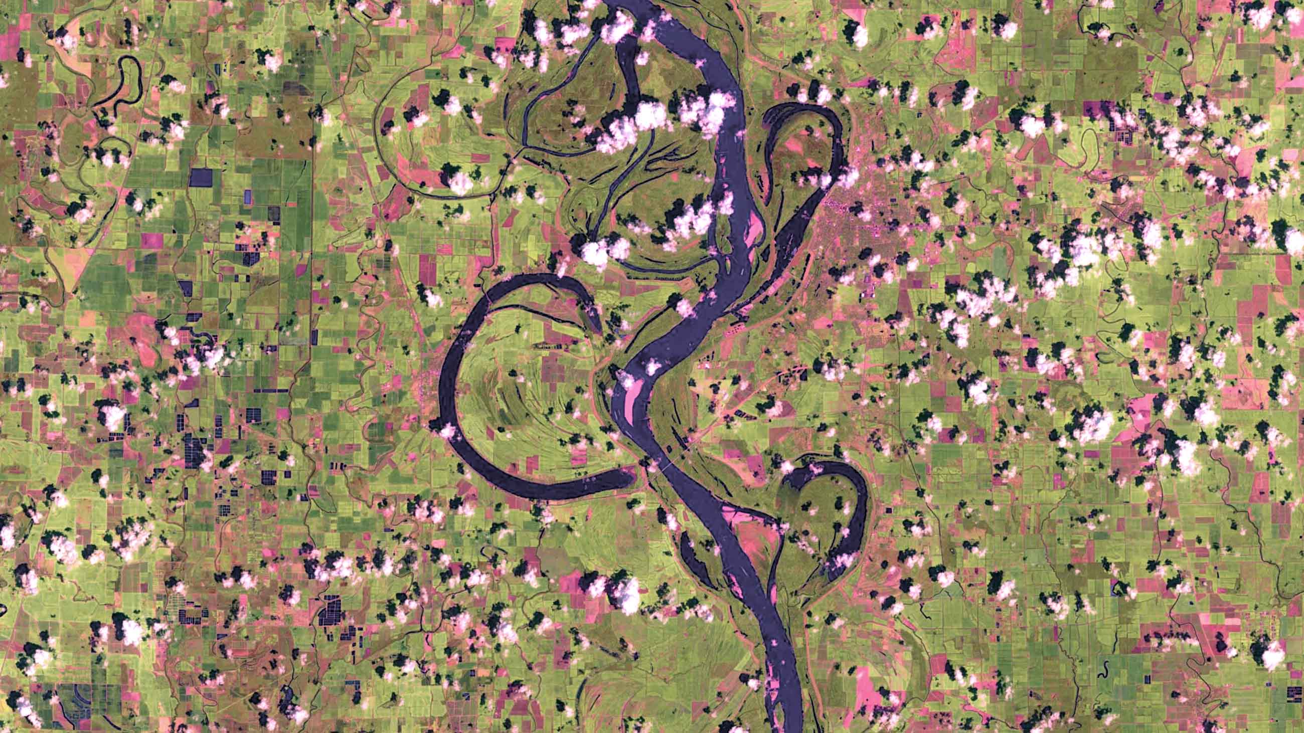
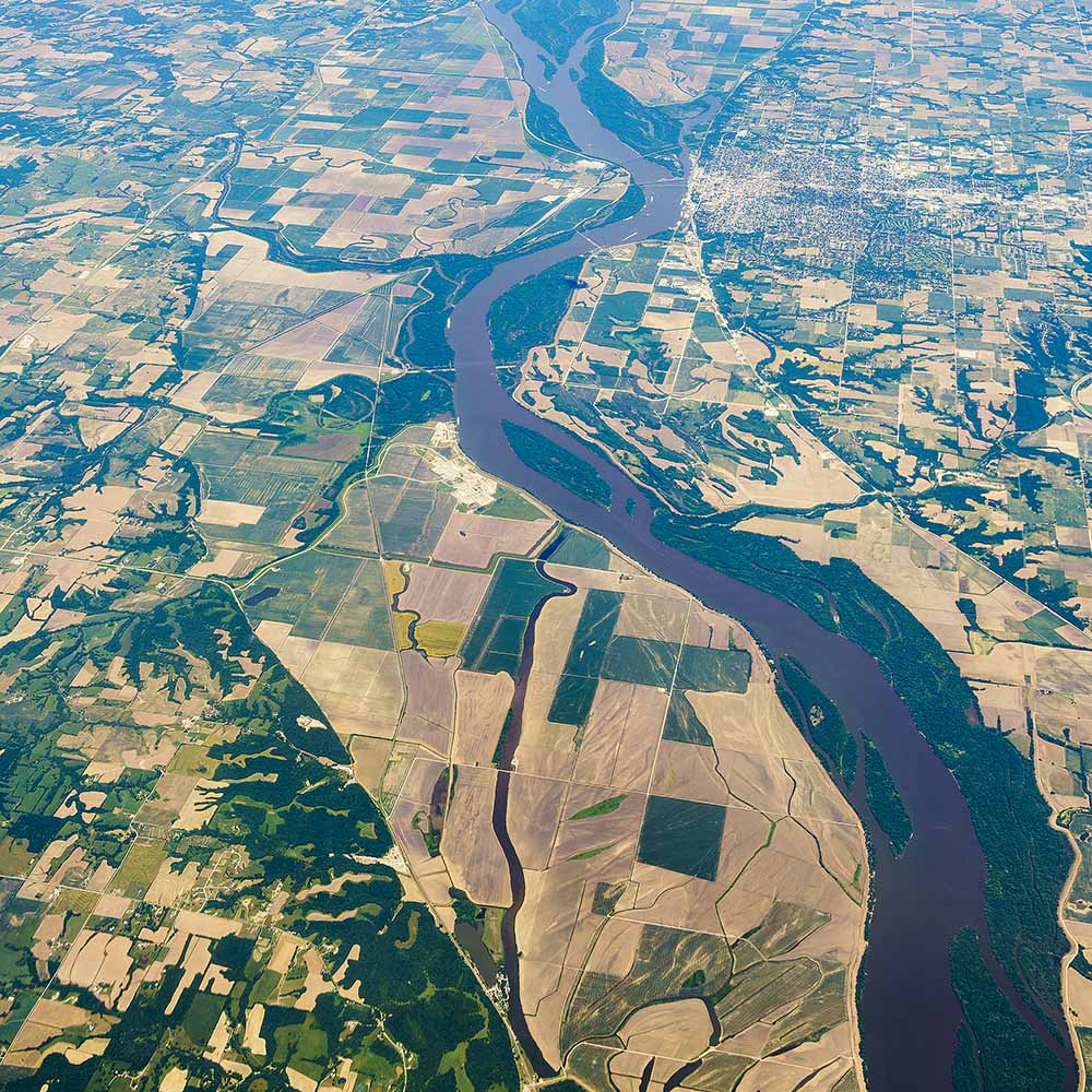
For the seven hundred miles upstream from Baton Rouge, Louisiana, all the way to the mouth of the Ohio River in Ballard County, Kentucky, much of the river is sheathed in lush corridors of woods and wetlands — often 10 miles thick. The batture, as these woods are known, form one of the few long-distance wilderness corridors left in the continental United States, a remarkable and underappreciated aspect of the Mississippi. They have persisted not because they have been deliberately protected or preserved, but because they sit inside the protective levees we’ve built along the nation’s mighty backbone. Seasonally flooded by the river, these areas are unappealing to development.
But for reasons complex, historic, and muddy, the life in these woods — and perhaps the entire lower Mississippi ecosystem — now depend greatly on the slow-moving, seasonal backwaters that thread through these riverside forests. And those backwaters, a growing chorus of scientists say, are beginning to disappear.
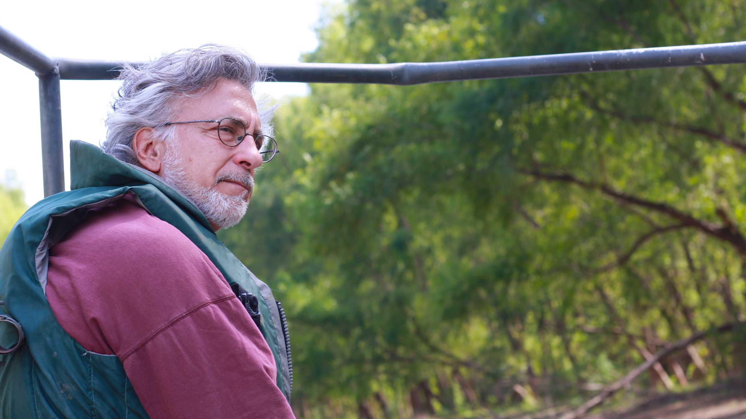
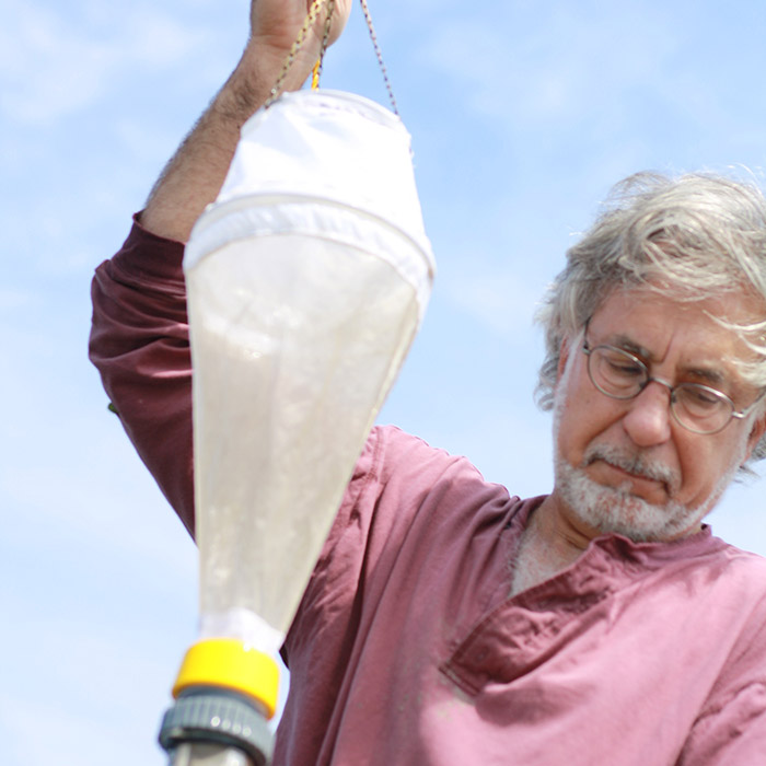
One of those scientists is Cliff Ochs, a biologist at the University of Mississippi. A few months ago I joined him and one of his graduate students on a trip to the batture in middle-of-nowhere Arkansas. Their target was a “borrow pit” — a small, man-made lake left behind after the dug-up earth was turned into a levee — where they gathered microbes that form the bottom of a mighty food chain.
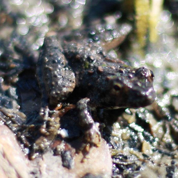
The batture and its backwaters provide refuge for many of the region’s endangered species — the pallid sturgeon, the pocketbook mussel, the interior least tern, the Louisiana black bear —and a vital stopover for more than one hundred species of migrating birds. As we pushed past the overgrowth to the edge of the water, Ochs slipped free of his off-brand Crocs and in bare feet, slid four inches deep into muck. To work on this river, he said, you’ve got to come to peace with mud. Later that afternoon, he revealed the extent of his peace: After wiping his hand along a dredged-up anchor, he brought a palmful of lake-bottom mud to his face. “Sometimes you smell the science,” he said.
Ochs’s work focuses on the backwaters of the Mississippi batture — those thin lakes or old chutes only partially or seasonally connected to the river’s main channel. The backwaters form a watery connector between the river and the batture’s woods, slow and quiet stretches where fish can spawn and mammals can water. Over the years, Ochs has watched the mud build up in these quiet corners, sometimes a foot or more in a year. The river’s floods will wash much of the mud away, but nowadays not enough, which means these backwater lakes are disappearing.
That’s a problem. The small bodies of water are the last remaining province where, in Ochs’s words, the lower Mississippi River’s “brown turns to green.” As the river rises — as much as 40 feet in an average year — and connects with these backwaters, it delivers the “brown” in the form of sediment and nutrients. Then, as the river drops, the backwaters are re-separated. Since the water moves more slowly in these backwaters, the sediment sinks, which means that light can better penetrate the water. With that light, algae — the “green” — can get to work.
The algae consume excess nitrogen and phosphorous (including pollutants carried from farm runoff and urban pollutant, which, as a bonus, helps reduce the hypoxic dead zone in the Gulf of Mexico), and provide a foundation for entire food chains. Fish grow fat, new fish are born, and when the river and backwaters reconnect again, all that biomass pours back into the river system.
“The river system as a whole — the ecological foundation of the river system, and the way the river functions in cycling nutrients — depends very, very much on its connection with the floodplain,” Ochs says.
Without a wetland floodplain, in other words, the Mississippi River’s ecosystem is incomplete.
For thousands of years, before European colonists and modern engineers began to remake the river, the Mississippi’s alluvial valley constituted one of the greatest wetlands in the world, up to 100 miles wide in places. This was an ever-changing place: During a flood, the water used to pour over thin “necks” of land at the edges of the Mississippi’s famous horseshoe bends. The force of the water would scour a new channel, and the old bend, now disconnected from the river, would become what a backwater lake called an oxbow. Such lakes, Ochs notes, had an entirely natural life-cycle — forming, thriving, and, in time, naturally dying. The water that runs off the surrounding terrain carries sediment, and when that water reaches an oxbow lake, the sediment settles to the bottom. Over time, the lake infills and disappears.
But when we disturb the soil — by, say, cutting down trees, planting cotton fields, and driving over them with our tractors, year after year — more sediment is carried downstream, increasing the rate of infilling. That affects all of the river’s lakes, whether they are inside the current levees or in the portions of the floodplain cut off by the levees, most of which has been converted to farmland. In the Mississippi Delta, as the famous stretch of cotton and soybean fields south of Memphis are known, the ancient oxbow lakes of the region are disappearing at an accelerated — and some would say alarming — rate. One Mississippi scientist, in a paper published in the journal Fisheries last year, suggested these vanishing backwaters merit the same “conservation attention afforded to our national parks and wildlife refuges.”
As far as the river’s geology is concerned, though, the age of the oxbow is already gone. Decades of engineering have halted the river’s natural tendency to wander to new channels, and the remaining oxbows never reconnect to the main channel to participate in the system’s elegant ritual of replenishment and nutrient movement.
Today it’s only the lakes inside the levees – the few but mighty, and the ones that so concern Ochs and his team – that still nourish and replenish the Mississippi ecosystem. And they are now threatened, too.
Ochs had suspected for some time that that these batture lakes might be rapidly infilling —perhaps at even faster rates than those outside the levee— and a 2008 paper by a geomorphologist confirmed this hunch. Over their lifetimes, embanked lakes — those inside the levee — have infilled, on average, by 67 percent. Outside the levee, the average is just 37 percent. That difference becomes shocking when you realize the different timescales: Many of the oxbows outside the levees are prehistoric. Nearly all the embanked lakes, meanwhile, are less than 100 years old — and yet it is the latter, far younger lakes that are now almost gone.
Why? Mainly because the Mississippi is a muddy river — it holds high volumes of sediment. Now, instead of spreading across the historic floodplain, all that mud is contained inside a narrow corridor. The lakes inside the levee simply get more mud than they can handle.
Ochs, then, sees no reason why the rapid rates of infilling would slow.
“Over another 60 or 80 or 90 years, if nothing is done to retain that connection to the backwaters, [those lakes] will fill in,” Ochs said. “That will completely alter — I think in a very, very negative way — the ecological integrity of the river.”
Our common image of an unnatural river — dead to wildlife – would finally be true.
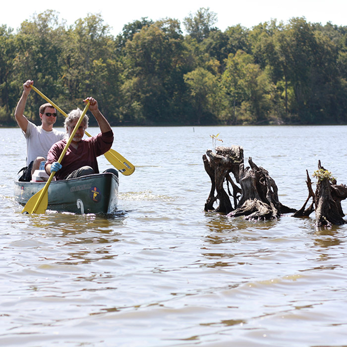
After leaving the borrow pit, Ochs drove to a narrow oxbow that straddles the border of Mississippi and Arkansas. As we motored up the lake, we watched a pair of deer on shore, startled by the noise. That led to a discussion of the batture: its wildness and its importance, and its under-recognition.
“It looks like a wilderness,” Ochs said. “But it’s also a wilderness in terms of how much we know.”
Scientists call the Lower Mississippi — despite its star stature in American literature and song — one of the least-studied rivers in the country; indeed, one of Ochs’s students routinely discovers new species of insects.
The Upper Mississippi is better understood — in part, Ochs said, because there has been much more federal funding for scientists there. It’s not that there’s no federal interest in the lower river, Ochs suggests, but that interest is almost entirely focused on controlling the mighty river itself, making sure that the farmland doesn’t flood, and that the valuable shipping corridor remains free and clear.
Given what we know about the river and its backwaters, there are things, Ochs says, that we can and should be studying. At the current rate of infilling, for example, how long can the remaining lakes stay connected to the river channel? How do floods and droughts affect those rates?
But Ochs is worried about even bigger questions — questions that can seem beyond the scope of science, and enter the realm of ethics and responsibility: What right do we have to make big engineering decisions whose long-term consequences we cannot know? What do we do next on a river that’s already been so thoroughly engineered?
Ochs and other scientists sometimes talk about a radical dream. It would be a different kind of engineering, undoing, at least slightly, some of our previous work. Ochs personally imagines destroying the current levees and building new ones just a bit further back, widening the floodplain again and giving the river just a little more room to carve out new lakes. “I just love the idea of this wild place bisecting the middle of the country,” he said, the splash of his sampling net breaking the silence. “You’d have to cross it — whether you want to or not.”
As the deer disappeared into the woods, it struck me that while we’d seen plenty of animals we’d seen no one else in the batture all day. That, Ochs said, is true of many of his days in the field. Hidden behind the levees, the batture and its backwaters have been forgotten. That has given these woods an appealing loneliness — but it may also spell its doom.
Boyce Upholt is a writer based in the Mississippi Delta. His writing has appeared in, among other publications, The Atlantic, The New Republic, The Houston Chronicle, and the Jackson Clarion-Ledger. Research for this story was supported in part by funding from the Lower Mississippi River Foundation and the Mississippi Delta National Heritage Area, through the National Park Service.
Comments are automatically closed one year after article publication. Archived comments are below.
This is important! Thanks for reporting
Great job Boyce!