


The Burgeoning Science of Search and Rescue
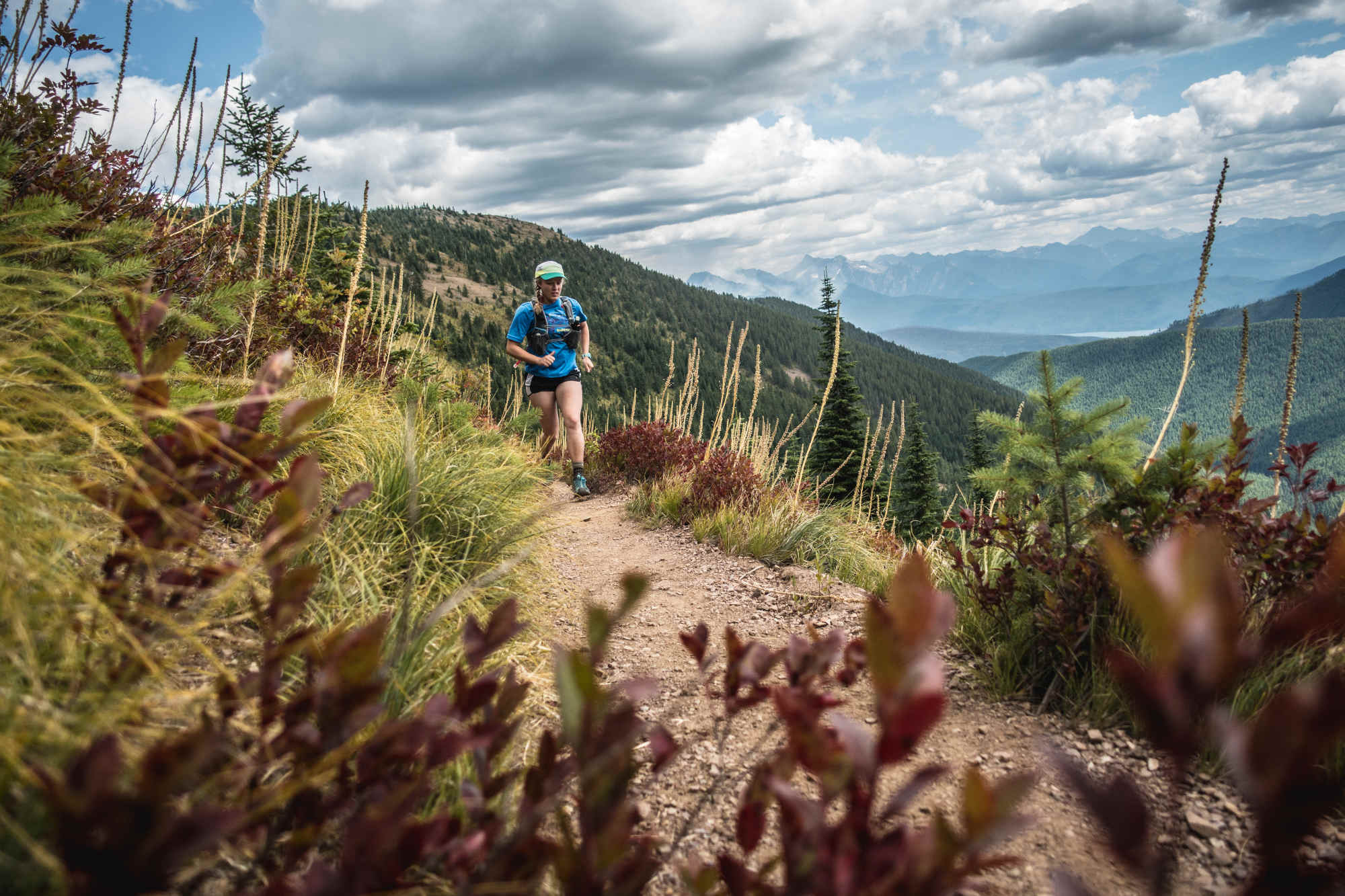
On May 5, 2023, a 19-year-old hiker named Matthew Read headed out on a roughly 12-mile trek in an underpopulated part of Glacier National Park in Montana. Read, a chemical engineering student, had stopped in Glacier while driving home to Michigan, and the pine-surrounded path he embarked on was known for its big views of the Livingston Range, a set of jagged peaks to the east.
He would get a longer look at them than he anticipated.
By Sunday, two days later, the young hiker had yet to return. That afternoon, national park rangers started a ground search; that night, a helicopter team scanned from above. The rangers, though, were thwarted by a lack of clues, the chopper by meteorology: Clouds hung low, fog obscured the view.
That Monday, the search team grew to 30 people, and included the U.S. Border Patrol and Flathead County Sheriff’s Office, along with search dogs. It would expand to the North Valley and Flathead search and rescue, or SAR, teams.
In situations like this, a subfield of science can help those SAR teams know where to start — and how a college kid lost in big bear country might behave. It’s called, appropriately, lost person behavior.
The study expanded in the 2000s, with a researcher named Robert Koester. In 2008, Koester compiled, analyzed, and published data on how different types of people behave when wandering the wilderness — and how to find them. His work has become foundational to the field of lost person behavior, and a cornerstone of how SAR teams plan missions to find people who have wandered off the beaten path.
While it’s hard to come by solid numbers because there is no mandatory centralized place where SAR teams must file reports, in 2021, nearly 3,400 people needed help getting out of the wilderness in U.S. national parks alone (a minority of the land where people need rescue).
In a field where even minutes matter, efficient search tactics can mean the difference between life and death.
In the 16 years since Koester’s initial work, he and other researchers have added nuance, filled in gaps in the initial framework, and built new technological tools. But moving new research out of the ivory tower and into the outback isn’t simple: When searchers are seeking a kid who wandered from camp in mountain lion country or an alpinist unconscious in an avalanche, trying a new tactic isn’t often at the top of the priority list.
But in a field where even minutes matter, efficient search tactics can mean the difference between life and death. Those high stakes inspire researchers to travel farther down the path, following the data where it forks.
Systematic searches largely trace back to World War II, when spotter planes would use grid searching to detect German U-boats.
Around the late 20th century, SAR professionals in the U.S., the U.K., Canada, and Australia were formally reporting land-based rescue missions, pulling out statistics on things like why people had become lost, and for how long. The most influential of these professionals was a researcher named William Syrotuck, who analyzed a few hundred cases total, wrote up the results in book form, and represented the first attempt to sort lost people into categories (children, hunters, hikers, elderly persons), take stock of their collective actions separately, and chart how far they tended to wander.
The statistics on lost people didn’t come from large sample sizes, and so their behavior profiles weren’t quite cemented until Koester came along.
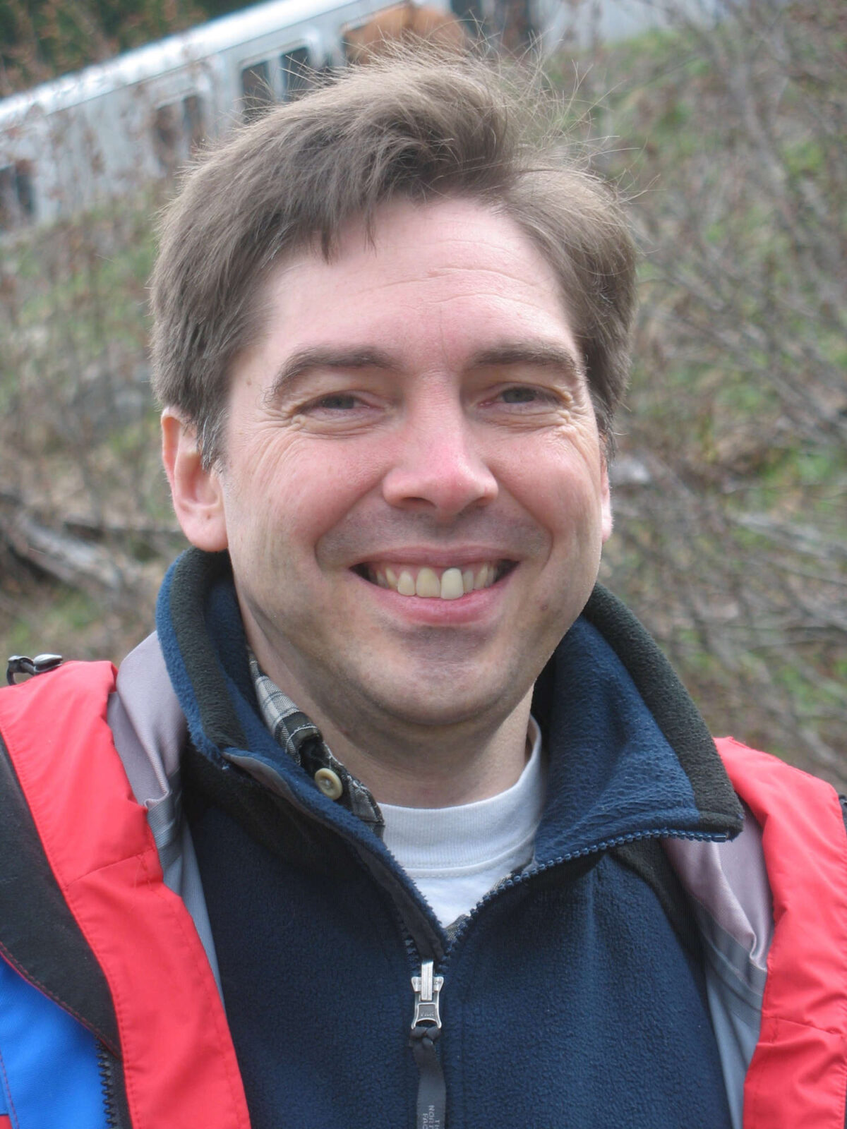
Researcher Robert Koester, whose work on how different types of people behave when wandering the wilderness has become foundational to the field of lost person behavior.
Visual: Courtesy of Robert Koester
Koester’s interest in search and rescue began as a Boy Scout, when his troop did a mock emergency scenario: They were tasked with finding a man who had gone into the woods to chop down a tree and hadn’t returned. The young Koester was put in charge of strategy.
Years later, as a student at the University of Virginia, Koester joined the school’s SAR team — which was often sent out to seek lost people with dementia. It didn’t take long for Koester, who has the demeanor of a helpful park ranger, to see patterns in their behavior and connect their waypoints. Early on, he came up with a rule of thumb — literally: If he placed the bottom of his thumb where a person had last been seen, they could generally be found within the finger’s length on a standard topographic map.
One late night, his phone rang. “I get this panicky phone call from the search planner who’s like, ‘Bob, I absolutely have to know the length of your thumb,” Koester recalled.
“That’s a silly way of doing business,” he thought. Too subjective. What if, instead, he recreated Syrotuck’s statistical work, but added a new category? Syrotuck, see, had grouped everyone over the age of 65 together. But seniors with dementia behaved differently in the wild than those without.
In 1989, Koester examined the search and rescue mission reports of two dozen people with dementia. “I sometimes jest that my entire SAR career was originally based upon my ability to average 24 numbers together,” he said.
Despite the study’s modest beginnings, Koester has gone on to larger endeavors — becoming, essentially, the father of a field that he began pursuing in his off hours. In the 2000s, as part of a project he undertook with another researcher that was funded by the U.S. Department of Agriculture, Koester gathered the details of more than 50,000 lost person cases and compiled them into the International Search & Rescue Incident Database, or ISRID, centralizing case details that had previously been scattered.
“I get this panicky phone call from the search planner who’s like, ‘Bob, I absolutely have to know the length of your thumb.”
“He’s just the king of search and rescue,” said Krystal Dacey, a geospatial researcher at Charles Sturt University in Australia. She and other researchers rely on ISRID’s information and Koester’s previous analysis for their own work. “In the SAR research community, it’s mandatory to have as a source,” wrote John Nguyen in an email to Undark. As a student at Virginia Tech, he worked on a software project called the Lost Person Simulation Tool using the database and Koester’s research.
With all that data, Koester began renovating Syrotuck’s work, throwing into relief 41 different lost-person categories. Those human categories range from anglers to ATV drivers, hikers to mountain bikers. “I am sure for some future search there will be a need for statistics regarding female elderly light-wind board-sailers,” he wrote in the 2008 book that resulted from his work, called “Lost Person Behavior.”
For each category, Koester calculated, in quartiles, distances people typically traveled from the point they were last seen, and the elevation change they usually made. He also noted, among other things, how long they remained mobile, how close to features like roads or streams they were found, and what scenario led to their predicament.
School-age kids, for instance, often got lost because they tried to take a shortcut, and can usually be found within a mile of their last known position; more than half are found in structures, yards, or vehicles. Hunters, meanwhile, travel a similar distance, tending to go around 100 feet downhill and to take that journey off-trail — and usually get lost because they followed an animal intently through dense brush. Cross-country skiers, meanwhile, often keep moving to stay warm, and go more than twice as far as hunters or kids — though, some are reported lost when they’ve already made it back to the local bar and failed to tell anyone.
Importantly, Koester also calculated how long people typically live, and how incident coordinators could use the information in real missions.
Support Undark Magazine
Undark is a non-profit, editorially independent magazine covering the complicated and often fractious intersection of science and society. If you would like to help support our journalism, please consider making a donation. All proceeds go directly to Undark’s editorial fund.
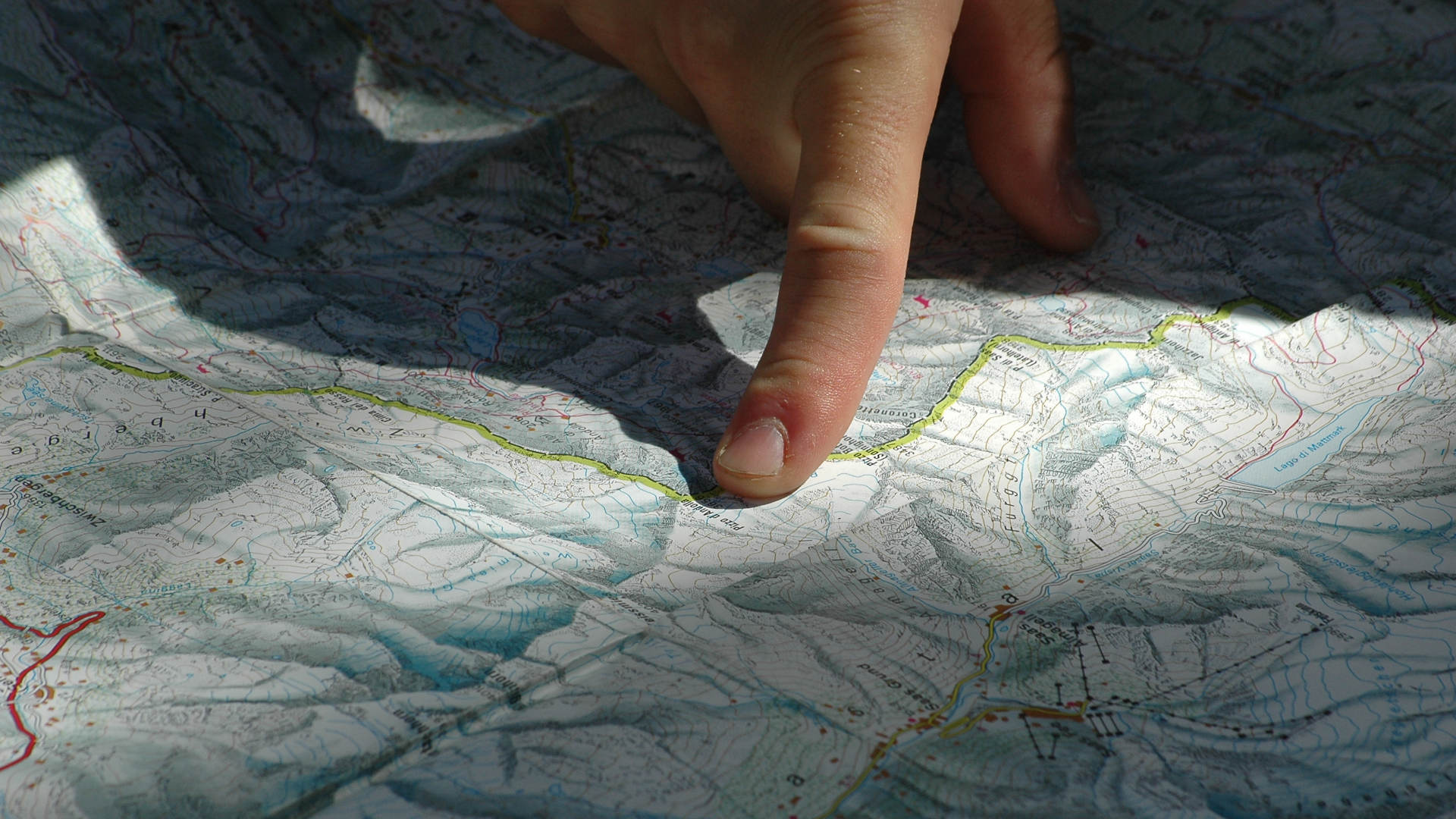
Search theory, though, is complicated and nuanced. In the field, search and rescue teams can take different approaches when scouting for lost people, but one traditional method is to establish the relevant area by taking the person’s last known position and bounding how far they likely traveled.
Teams may send members out to quickly check features like trails or other areas where a person’s profile suggests they are likely to be found. They search the immediate area, search the boundary of the relevant region, and suss out high-probability spots, like the locations of known hazards. If the lost person isn’t found, teams can fill in the rest of the broad area they’ve established, for example splitting the bounded area into sections that smaller teams can search. Searches also include external information personalized to the situation and terrain.
Koester’s findings also get integrated into courses on best search tactics. The search management curriculum from the Colorado Search and Rescue Association, for instance, focuses on Koester’s “Lost Person Behavior” and the big database. And they’re in the process of revamping it to include new strategies, according to Daniel Knudsen, who teaches search manager classes for the state’s search and rescue organization and is the field director of Park County Search and Rescue in Colorado. Through funding from the Department of Homeland Security, the book’s information now comes in the form of an app, also called “Lost Person Behavior.”
The search for Read, the engineering student in Montana, was managed by the National Park Service, which Koester has worked with. The local SAR teams who helped comb the mountains were involved in “manpower, not decision-making,” in that instance — meaning their members were pounding the ground, but not determining the strategy of their search. But according to Flathead County Search and Rescue president Anthony Palmiotti, “both Flathead and North Valley are very familiar with ‘Lost Person Behavior,’ by Robert Koester, and apply the principles and data in that publication in any search we may manage.” In fact, both teams and the air support had, in December 2022, recently attended a three-day Emergency Response International course together on SAR management and lost person behavior.
Read was lucky: He was found alive.
His journey was chronicled in a Flathead Beacon article: The piece reported that, three days after he went missing, a helicopter team was flying in the area he was last seen, demonstrating how an infrared camera could aid a search. (The flight itself was not part of the official search mission.) And then, they spotted something: Scoot marks in the downslope snow, followed by footprints.
After refueling and returning, the helicopter — with help from search crews — was able to follow those signs and eventually find Read himself, a white-hot spot on the infrared camera in a forest of cool trees. Soon, a rescuer was lowered down to Read, and then Read was lifted into the sky — almost hypothermic, very frostbitten, but alive.
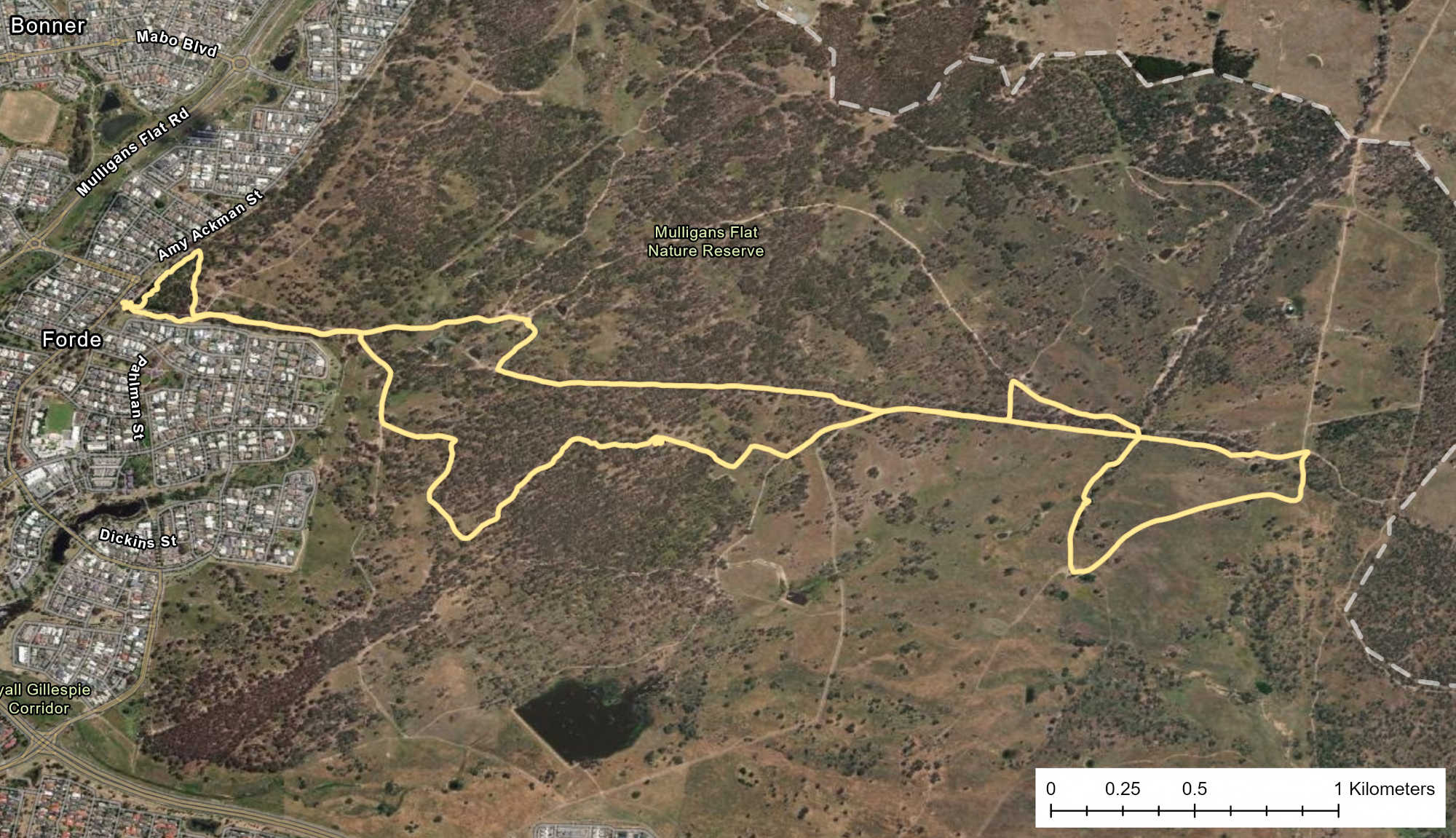
Searchers, and the public, later learned his story: When Read encountered a large, deep field of snow between two high points, he attempted to cross it, but slipped into snow that reached his chest. He’d lost his phone, his water, his shoes.
When he realized he couldn’t make it back up to the trail, Read decided to go down instead, scooting toward lower elevation along the path water would follow down a slope. At the end of the slope, he made a shelter and stayed for a few hours, before then attempting to find the road he’d driven in on. The terrain, though, was tough, the going slow, and so finally he turned to simply staying put. He built another shelter, near flowing water, and simply waited — an “excellent” strategy, according to “Lost Person Behavior.”
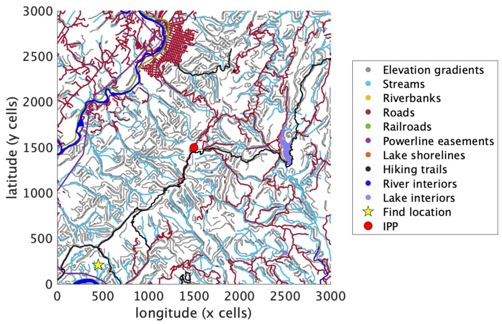
His near-final resting spot was about 3 miles from the trailhead, and a little over a mile from his intended destination — within the range rings searchers might have drawn on the map.
His decision to follow the drainage, and then stay near a stream, fits with Koester’s hiker profile. That means the search managers could have had a good idea that they might find him here, and so made plans to search the area: “Hikers are guided by terrain to other linear features,” Koester wrote. Of all find locations, linear features like streams account for the largest percentage of hikers. In this category, people tend to go downhill too, as Read did.
In a video posted from the hospital after his rescue, Read wears a khaki-green Border Patrol hat. “I just cannot say enough from the bottom of my heart how grateful and thankful I am for all of you,” he says to the searchers who found him, and the medical professionals who saved him.
Though Koester’s methodology has steered the field of search and rescue, there are few independent studies analyzing its effectiveness, and some of the categories in the book have small numbers on which to base their statistics. Still, the ubiquity of its use in real life-or-death situations, formalized SAR education, and further research speaks to the trust both the communities of SAR practitioners and SAR researchers have in Koester’s work.
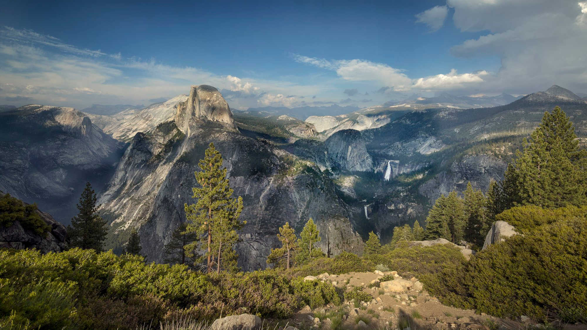
A National Science Foundation-funded study by Koester, as yet unpublished and not peer-reviewed, estimates that using the lost person behavior strategy has cut search times by around 50 percent. However, research like a 2014 paper led by a University of California, Merced, engineer points to gaps in the idea: The strategies are derived from, essentially, averaging data from across the world, including many places where the geography differs wildly. The paper suggests that in places with “limited geographic diversity,” like a landscape dominated only by rugged mountains, a generalized, smoothed-out strategy might not work as well. The paper specifically looked at Yosemite National Park, part of the Sierra Nevada mountain range and dominated by cliffs and canyons. A 2012 thesis had found something similar for Yosemite, and suggested instead looking at how many watersheds people tended to cross.
In a 2015 publication, researchers from Penn State, George Mason University, Kingston University, and a private consulting firm developed a metric, called MapScore, for evaluating how well a lost-person model performed — in terms of how well it would have predicted a real person’s behavior. In their initial publication, on which Koester is a co-author, they found that Koester’s model outperformed the 2012 watershed model, but combining the two into one idea performed better than both.
Matthew Read built another shelter, near flowing water, and simply waited — an “excellent” strategy, according to “Lost Person Behavior.”
Search and rescue techniques have been getting more refined as people, including Koester, have built on his work in the 16 years since his first book came out. In 2018, Koester co-authored a paper with geographers from the University of Graz in Austria, looking at a model that analyzes features like trails and streams, elevation changes, and behavioral profiles from ISRID to make a probability map displaying different places a lost person might be. He’s also been working with graduate students at University of Virginia on software that takes weather, landscape, and skill level into account when calculating how long people can survive. “Now, it’s just like a matter of finding funding to turn that into an app,” Koester said.
Software has become popular in SAR study. One variety is called an “agent-based model,” in which the “agent” is a digital version of a lost person that interacts with a simulated environment. Koester collaborated with Amanda Hashimoto and others at Virginia Tech on such a model in a 2022 study: It accounts for different “reorientation strategies” — ways people try to get themselves un-lost — which the agents use on their simulated trek through the wilderness. The researchers then compared real ISRID incidents to the paths of the simulated agents. The behavior of the simulated people, on average, fit more than half the real-world incidents well, according to the paper.
A follow-up study, in which Nguyen collaborated with Koester on the Lost Person Simulation tool, assumed that a person tends to keep orienting themselves with the same strategy for a while; it performed even better than Hashimoto and Koester’s model.
Despite the spate of research and new models, though, “there is currently no evidence to suggest that any of the spatial models,” except the one that involves drawing a math-informed circle around someone’s last known position, “have been used in real-time SAR incidents,” wrote Dacey and colleagues in an Australian Journal of Emergency Management study.
As part of her geospatial graduate work, Dacey has been building an agent-based model for practical field use. The “agent” is given rules to abide by — based on the nature of the environment, lost-person behavioral profiles, and a sprinkle of randomness, like an arbitrarily selected starting point and initial direction.
Dacey’s model also incorporates two geographic layers of the search — steepness and the density of vegetation — to approximate ruggedness, and uses them to estimate how long it would take someone to cross a given section. “When you’re lost, and you don’t know where you want to go, the terrain is what’s really driving you,” she said. Koester’s qualitative descriptions of people’s behavior does account for terrain, though the traditional focus in mission planning can tend more toward straightforward numerical variables like elevation change, distance traveled, and the angle walked from the initial starting point.
When the simulation runs, the agent can decide, at each increment of time, whether to move, and in which direction. It keeps track not just of where the agent is and has been, but how long they have been lost, how far they have gone, how tired they are — almost like a video game character whose energy bar is slowly depleting.
Right now, running the model, which could show both where a lost person might be, and a SAR team’s path of least resistance to them, is too computationally intensive for the backcountry, but Dacey is building it with future real-world use in mind; Australian SAR teams still learn to make their search plans — informed by lost person behavior — on paper maps.
One big thing holding Australian SAR teams back from new technology, Dacey says, is that what they have works: They successfully find most lost people. “When there is a time-sensitive thing like a search on, they probably aren’t super confident to go, ‘Okay, well, let’s use this new technology.’ They’re like, ‘Let’s do what we’ve always done.’”
For that reason, Dacey is hoping to prove her model’s worth by using it in cold cases — finding the remains of those people who weren’t found initially, based on reconstructing their behavior.
“I’ve been on searches, and you see the family there,” Dacey said. “And you see how devastated they are.” She’s motivated, she said, to do “anything to help those people.”
Over in the U.S., Matt Jacobs, a longtime member of multiple California SAR teams, is also trying to bushwhack the way to the future of search theory. Jacobs is an MIT-educated software developer who now runs a company that distributes an app called SARTopo, a mapping software aimed at search and rescue teams.
Using SARTopo, teams can overlay all sorts of geologic and geographic data, plan and plot search areas, and live-track themselves and fellow members, among other functions. In 2015, Jacobs published a paper that took another look at the incident information in the large ISRID database. Taking the largest ISRID categories — hikers, hunters, and gatherers — he tried see how the terrain affected their choices.
Historically, the plan to look for a lost person has sometimes involved a kind of grid search, with evenly spaced people walking in relatively straight lines. That idea calls back to maritime search philosophy, where SAR began: It assumes that searchers can uniformly survey a space where they’re likely to find someone. That may be true on an ocean, but on land, there are cliff bands and dense pockets of deadfall and briar patches that limit where someone may go, and how well they could be spotted. Koester has not advocated for grid searching in his own work.
“When you’re lost, and you don’t know where you want to go, the terrain is what’s really driving you.”
Starting with the locations where people in ISRID were found — and looking at them in isolation, independent of where they were last seen — Jacobs drew an approximately 2-kilometer radius around those spots. Within the resulting circle, he analyzed terrain features near which the lost had been found: things like the intersections of streams and trails, or peaks.
The results were striking, with 60 to 80 percent of people discovered close to terrain features like high and low points, ridges, roads, trails, or streams, as Read was. Injured people, for instance, are 12 times more likely to be found near the interface of a stream and a trail, seven times more likely to be found on a trail, and 3.5 times more likely near just a stream, as compared to a random spot within the circle. Among the uninjured, stream-trail junctions, trails, and roads top the list, with seven times, five times, and three times probability of containing the lost person, respectively.
Given those numerical wins, Jacobs has suggested the idea that broad, grid-like searches over a given area should only happen once SAR teams have picked over relevant geographic features like the intersections of streams and trails. People like Knudsen and Ben Wilson, education director for the Colorado Search and Rescue Association, also now teach this. As the mission ventures farther from the person’s last known position, Jacobs wrote in his 2015 paper, searchers should focus even more on those linear features.
For Koester’s part, he sees Jacobs’ analysis as consistent with the behavioral trends he found in the hiker category and points out that he discusses the importance of terrain features. While Jacobs may put different emphasis or interpretation on how those features play into a search plan, Koester wrote in an email, “I have emphasized linear features as long as I have been doing research. Perhaps it was a bit more obscure in the book than in one of my in-person classes.”
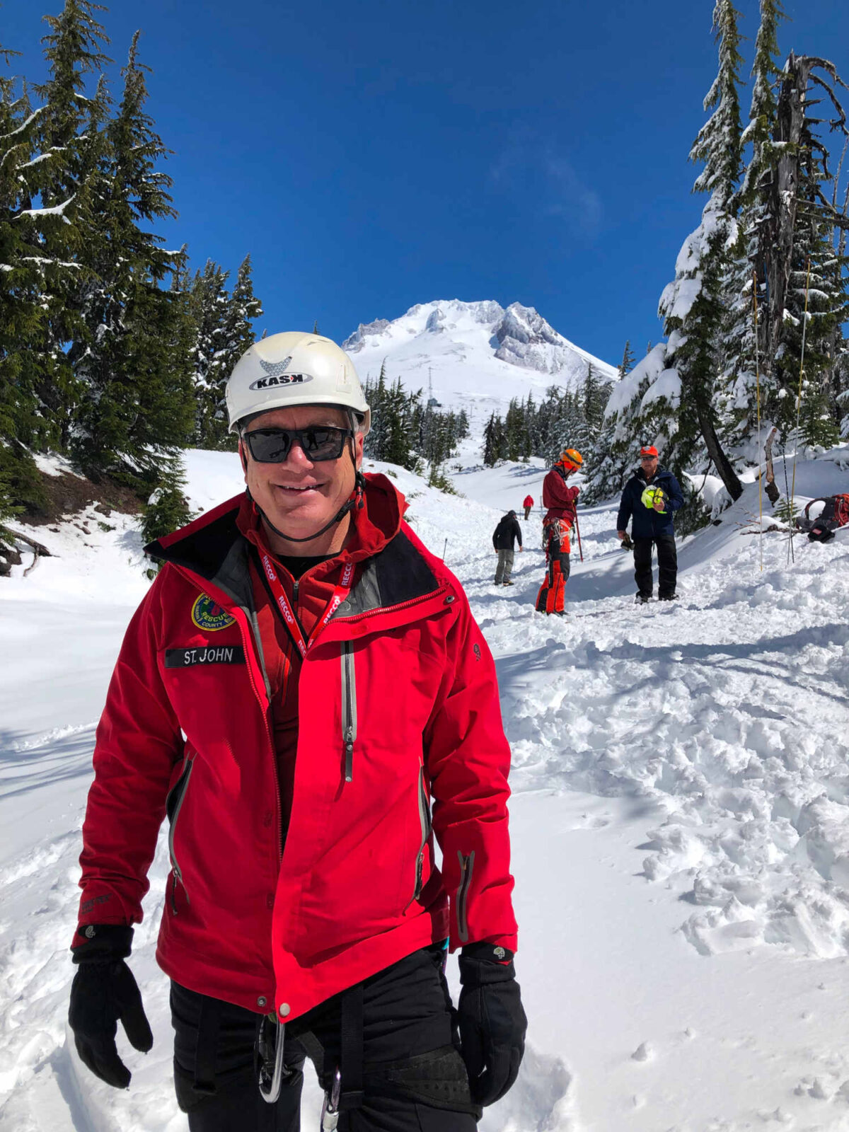
Michael St. John leads the Search and Rescue Unit at the Marin County Sheriff’s Office in California. He is pictured here attending a Mountain Rescue Association Conference at Mt. Hood, Oregon.
Visual: Courtesy of Michael St. John
Changing the strategy to one more focused on planetary characteristics doesn’t mean abandoning lost person behavior, said Michael St. John, who leads the Search and Rescue Unit at the Marin County Sheriff’s Office in California. Together with Jacobs, St. John developed and teaches a course, certified by the National Association for Search and Rescue, that incorporates Jacobs’s research and the SARTopo software itself. This allows the whole team to GPS-track themselves on one map that search managers can also see — and so keep track of where the team is, determine well an area is covered, and give direction from their big-picture position in the office, as long as the team members have cell service.
Within the rings, he and Jacobs suggest in a new version of the “lost person incident management” course they teach, teams should focus on the most promising terrain features, rather than focusing on searching a delineated area. “This is now, I think, a more holistic approach,” agreed Wilson.
GPS tracking of team members is one tool; telling them where to look based on the terrain is another; lost person behavioral profiles, St. John says, are another. SAR, complicated as the Wild West, needs them all to account for the strange and dangerous situations in which people find themselves. “There’s going to always be outliers,” said St. John.
Soon, search efforts will have more data and analysis, to sharpen those tools: Koester has been gathering new case reports, ISRID now has around 300,000 incidents, and “Lost Person Behavior” is getting a second edition. Koester guesses the number of person-categories will shoot up to around 75, including new ones like BASE jumpers — people who leap from objects like bridges, buildings, or cliffs — that are wearing wingsuits.
It’s not quite female elderly light-wind board sailors, but it’s homing in on that destination.
Comments are automatically closed one year after article publication. Archived comments are below.
Use what3words or tracking devices, carry flares, and never hike by yourself
Enjoyed this article a lot. Readers might be interested in my book, Deadly Frontiers: Disaster and Rescue on Canada’s Atlantic Seaboard (2001). Its first chapter is about Lost Person Behaviour, focusing on Canadian William Syrotuck’s pioneering work, and on Ken Hill, an American psychologist in Halifax, Nova Scotia, who extended Syrotuck’s research. All of it fascinating, including Koester. Thanks for writing it Sarah Scoles.
Readers of this article might or might not be aware of a British Army search technique developed decades ago – the Winthrop Search or “Winthropping”:
https://chiron-k9.com/wp-content/uploads/2019/02/Winthropping.pdf
“Initially used for counter-terrorism
in Northern Ireland in the search
and location of weapons caches,
winthropping is a technique of
identifying movement across, as
well as within, landscapes . It
examines the way in which
prominent markers, features and
boundaries motivate, influence or
constrain people’s behaviour. ”
Does this ring any bells?
We were taught this technique at the then Hong Kong Police Training Contingent (now tactical unit) in the 1960s.
There is an ongoing and increasing problem in Hong Kong with hikers getting themselves lost in mountainous and remote and difficult terrain and several have never been found.