


Flood-Risk Figures Get Friendlier
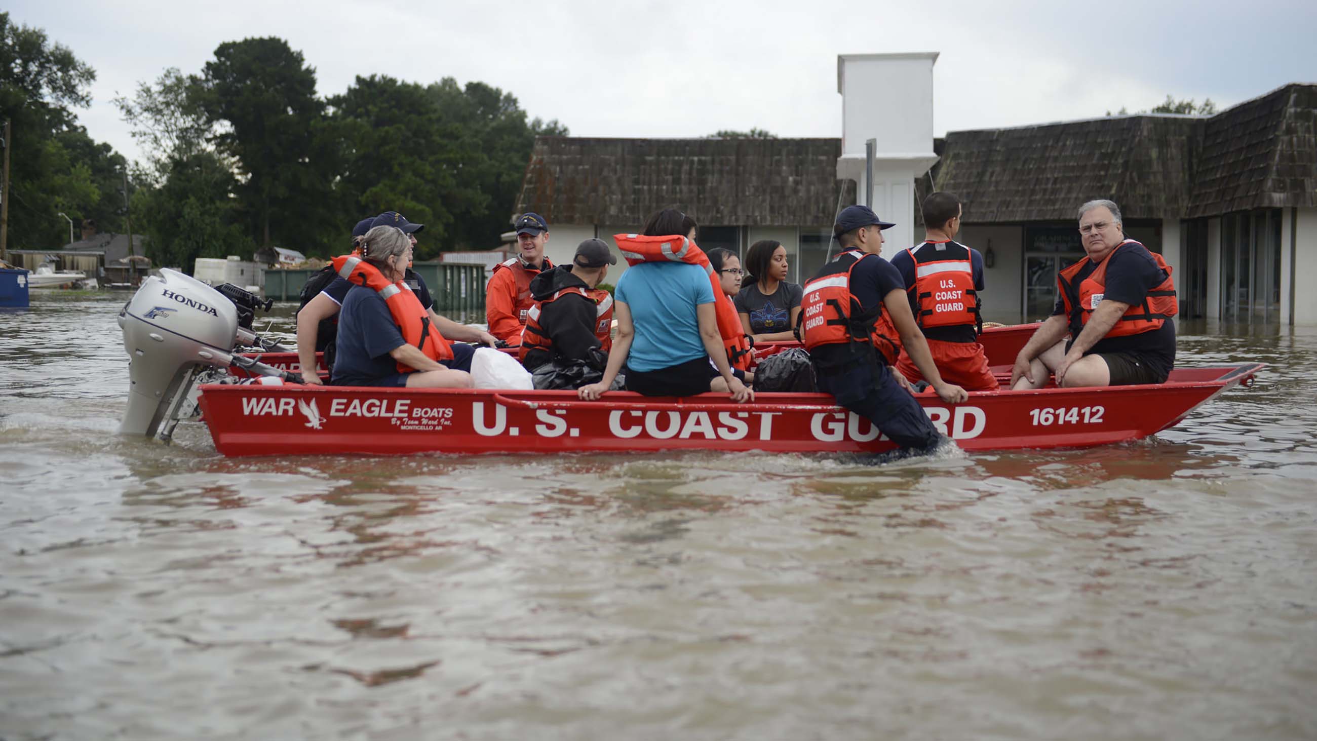
Aerial footage from August shows the extent of flooding in just one community in East Baton Rouge Parish. A new study offers a more detailed picture of regional flooding risks.
People in Louisiana are used to floods. But high waters in several rivers last summer set records, destroying 75 percent of the homes in and around Baton Rouge and Livingston Parish, according to one report, and killing 13 people statewide.
Ronnie Rosevear, a credit manager who lived in Livingston with his wife and three children in a house that had never flooded in 23 years, counts himself as one of the lucky ones. Amite River floodwaters swept into his home around 6 a.m. on August 13. “We’ve seen the river crest to 38 or 39 feet plenty of times,” he says. “The worst we’ve ever seen was 41.5, but this was 46.2.”
Water destroyed 90 percent of his family’s belongings as well as four vehicles parked outside. The house was insured, so Rosevear and contractors have been reinstalling Sheetrock, plumbing, and flooring. He and his wife finally got to sleep in their own home again a few weeks ago. Other families still were living in tents at that time, he says.
Flood risk in the past 30 years has mainly increased in the swath of land that stretches from southeastern Louisiana to southern Florida and in the northern half of the contiguous U.S. The risk has actually decreased in the rest of the South. That’s according to a new analysis by Louise J. Slater of Loughborough University in the U.K. and Gabriele Villarini of the University of Iowa, published December 21 in Geophysical Research Letters.
The work is based on calculations of the number of days per year that water surface elevation (also known as the stage or gage height of a river) at more than 2,000 locations nationwide exceeded contemporary flood risk estimates for those regions.
And whereas extreme rainfall in the short term is the obvious main cause of floods, another factor plays a big role, Slater and Villarini found. Flood basins have something like a long-term memory. Precipitation accumulates throughout the year in soil, groundwater, accumulated snow, rivers, streams, and lakes, leading to more stored water in a drainage area.
This volume of water defines the “basin wetness,” which the team was able to determine using data collected by NASA’s GRACE (Gravity Recovery and Climate Experiment) satellite. And the extent of a region’s basin wetness is a strong predictor of flood risk, the team found. (Such information could become unavailable if NASA’s earth-monitoring mission is curtailed, as advisers to the incoming presidential administration have threatened.)
The new regional trends are important because such analyses are uncommon, Slater says. And the way she and Villarini chose to measure and convey flood risk is important too.
Flood risk is usually expressed as the chances of exceeding a given rate of stream flow, measured in cubic feet per second. But few of us think in those units. We’re more likely to think of rise in surface water elevation. Just as Rosevear did back in August.
Rosevear is a weather buff, so he usually studies up on incoming storms. “But especially in our area we thought that there was no way that the water was going to get here,” he says.
Perhaps if they knew about the uptick in the region’s flood risk, he and his neighbors would have been better prepared.
“The vastness and wide spread that this thing had is amazing,” Rosevear says. “That’s the only way to say it.”