Learning to Love the Great Black Swamp
On Saturday, August 2, 2014, the water supply for the city of Toledo, Ohio, was poisoned. Officials issued an unequivocal order to the half million residents connected to the municipal intake: Don’t drink, cook, or brush your teeth with the water. Do not use it to bathe your children, nor people with weakened immune systems. And don’t give it to your pets. Stores ran out of bottled water, leaving residents to queue up at local fire stations or even travel to neighboring states to find alternative supplies.

An Ohio resident holds up a jar with water collected from Lake Erie at Maumee Bay State Park in 2014.
Visual: Aaron P. Bernstein/Getty
The culprit was a bright green plume of Microcystis, a cyanobacterium that thrives in warm water containing heavy loads of phosphorous and nitrogen. In spring, rains wash a pulse of nutrients off the surrounding region’s fertilized farms and send it down the Maumee and Sandusky Rivers and into western Lake Erie. And in summer, as water temperatures rise, Microcystis forms an iridescent mat over parts of the lake’s surface. In early August of 2014, strong winds blew a lawn of cyanobacteria over Toledo’s water intake, which lies just outside the Maumee’s mouth. Tests showed that the city’s water contained dangerous levels of microcystin, a liver toxin produced by the bloom.
The source of the problem stretches for thousands of square miles across northwestern Ohio and eastern Indiana. The rich earth and the hard work of farmers in the region produces hundreds of millions of dollars’ worth of soybeans and corn, as well as wheat, vegetables, pork, and poultry. The landscape is a vast, flat expanse of tidy fields and modest farmhouses crisscrossed with county roads — but it wasn’t always this way. Centuries ago, this part of the Midwest was a wild expanse of wet forest and marsh stretching across a million acres, and early settlers who slogged through the muck and mosquitoes called the place the Great Black Swamp. A missionary who traveled the area in 1781 described “deep swamps and troublesome marshes … the horses at every step wading in the marsh up to their knees.” On an 1808 map, the swamp, which covered most of northwestern Ohio, was designated as “land not worth a farthing.”
But settlers came anyway, felling the giant sycamores and oaks to create roads, and digging miles of drainage trenches to slowly bleed the water away from the muck. By the turn of the twentieth century, blood, sweat, and ingenuity had transformed the swamp into some of the most productive farmland in the nation.
The tough people who conquered the Great Black Swamp did so at great personal expense, and they’ve passed down a deep and abiding loathing of wetlands. They are considered a menace, a threat, a thing to be overcome. These attitudes are enshrined in state law, which makes impossible any action, including wetland restoration, that slows the flow of runoff through those miles of constructed drainage ditches — the very conduits that, after each heavy rainfall, deliver thousands of metric tons of phosphorus and nitrogen to the Maumee, and onward into Lake Erie from which millions of people drink.
“Ohio has eliminated a large percentage of our natural wetlands,” says Sandusky County engineer Jim Moyer. “Well, I say ‘good,’ because that’s where I live.”
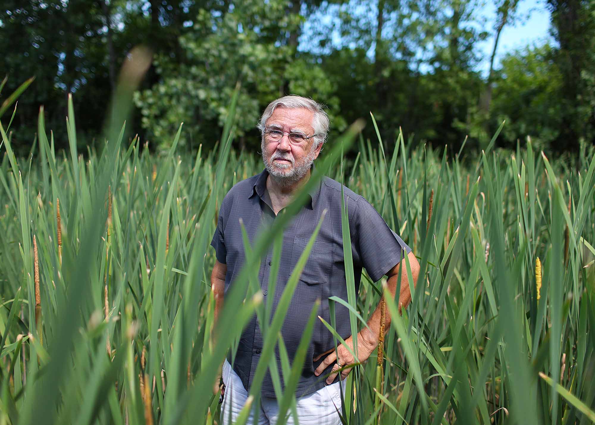
It was against this cultural backdrop, and in the aftermath of Toledo’s 2014 drinking water crisis, that William Mitsch, a wetlands expert and professor emeritus at Ohio State University, offered up a characteristically blunt solution. Harmful algal blooms have become chronic in western Lake Erie, he said, because of the wrong-headed way people manage the watershed. Mitsch proposed that a significant fraction of the region’s rich cropland be taken out of production and converted to wetlands, which act as natural filters for the overload of nutrients now flowing from farm to river to lake.
Mitsch’s idea strikes many locals as pure craziness, but that doesn’t bother him. A bearded, bespectacled man who knows wetlands in the intimate way most of us know our home towns, he built a wetland park at the OSU campus in Columbus, where he spent more than 20 years teaching and studying ecological engineering. He co-authored a textbook that has become a bible for students of wetland ecology and management — now in its fifth edition.
With an encyclopedic knowledge of close to 50 years of evolving science, Mitsch has become an eminent advocate for wetland restoration in a world where these habitats have become rare and precious. His dream for the former Great Black Swamp is based on a lifetime of studying the inner workings of wetlands.
Mitsch envisions tens of thousands of acres — or roughly 7 to 10 percent of the ground area here — being restored to wetland. “You’d need 10 percent of the landscape filtering for you so you can farm the other 90 percent,” Mitsch says.
That’s going to be a tough sell for the region’s thousands of farmers, who make their living off the soil laid down by the former Black Swamp. For them, says Kris Swartz, a farmer and president of the Ohio Federation of Soil and Water Conservation Districts, every bit of earth is valuable.
“Who’s going to give up the ground?” he asks.
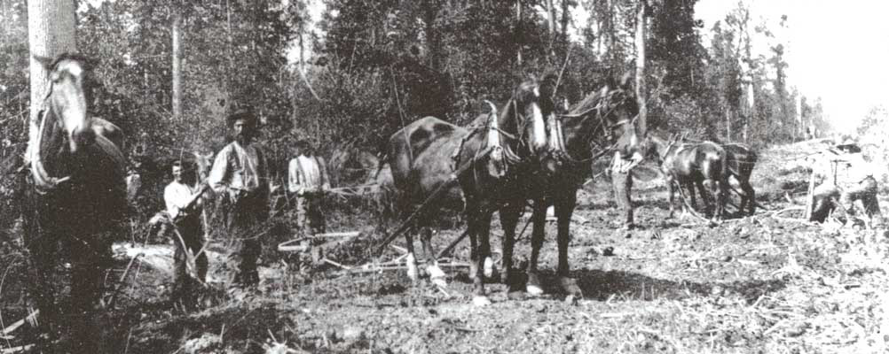
To understand just how outlandish Mitsch’s proposal sounds to many Ohio farmers, it helps to consider the struggles of early settlers in the Black Swamp. A soldier who crossed the wilderness during the winter of 1813 wrote that he and his comrades slogged through water six inches deep, underlain by ice. Often the ice broke, dropping them neck-deep in the swamp.
In summer, mosquitoes spread a disease that killed many and left survivors with a legacy of recurrent bone-rattling fevers. Malaria had first been carried to America in the veins of the British colonists who settled Virginia in the 1600s. Many of them came from the marshy parts of England: Kent, Sussex, and the shores of the Thames, where malaria had been endemic since the 15th century. People believed the illness was caused by bad air emanating from wetlands. They called the disease “marsh fever” and everyone knew the symptoms. A fever that returned every third or fourth day, making the sufferer first unbearably hot and then shuddering cold. A painful swelling of the spleen; weakness and a yellow complexion, because the malaria parasites destroy red blood cells.
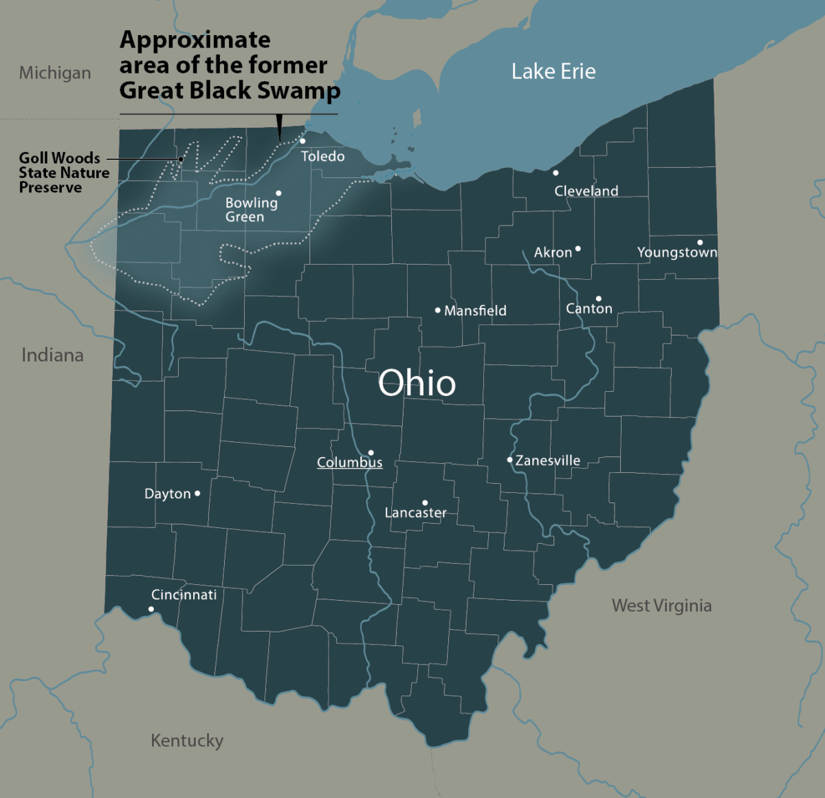
A missionary who traveled the area in 1781 described “deep swamps and troublesome marshes … the horses at every step wading in the marsh up to their knees.”
Visual: Undark
Malaria persisted through the settlement era. It would travel west with new waves of immigrants, cause great suffering and early death, and add to settlers’ loathing of wetlands. The people who colonized the Black Swamp would live and die in the shadow of the infection.
When General William Hull gathered troops to defend the city of Detroit in the War of 1812, his men had to push through the dark heart of the Black Swamp in spring, when the wilderness was at its wettest. Soldiers staggered thigh-deep in mud, with frequent stops to pry out horses and wagons stuck in the mire. At night they pitched tents, but the mud collected ankle-deep inside. They wrote of miserable, wet nights plagued by mosquitoes. Soon after, they suffered the fever and weakness of malaria. Encamped in the chill waters of the swamp, many of the sick died. One soldier, Elias Darnell, writing on Christmas Eve after Hull had surrendered to the British, noted that staying in the swamp killed more of his comrades than an intense battle.
Along with the hardships they endured, soldiers recorded the striking bounty of the Black Swamp and Lake Erie’s southwestern shore. On an April morning in 1813, two hungry soldiers stationed at Fort Meigs, near present-day Toledo, walked down to the Maumee River. The clear waters swarmed with perch, muskellunge, sturgeon, and catfish. Plunging spears into the water at random, they caught 67 fish in 30 minutes, often killing two or three with a single stroke.
Every river mouth west of the Sandusky held dense beds of wild rice, where waterfowl settled to feed, then rose in flocks that darkened the sky. The rice stalks stood taller than a man’s head: to feed, ducks grabbed the stems with their feet and tugged the seed heads down to the water. Waterbirds were so abundant, so fearless and loud, that their constant quacks and honks kept a nervous young army recruit lost in the swamp awake all night.
The choice farmlands in the Black Swamp were along streambanks, which formed strips of dry land that could be cleared of trees and farmed without artificial drainage. Inland from the streams, the soil was saturated with water and crops withered. A few German and English farmers settled in the swamp, cleared their plots, and dug ditches to channel water off of their fields. The advantages of this technique soon became obvious.
In 1859, the Ohio General Assembly passed a law authorizing county commissioners to construct drainage ditches. Farmers benefiting from ditch construction shared the cost. The other Midwestern states also enacted laws authorizing drainage districts, enabling the construction of vast networks of ditches that drained great swathes of land — a mission that required investment and coordination, and could not have been accomplished by individual landowners. Through the work of drainage districts, the Corn Belt states would lose more than 95 percent of their native wetlands.
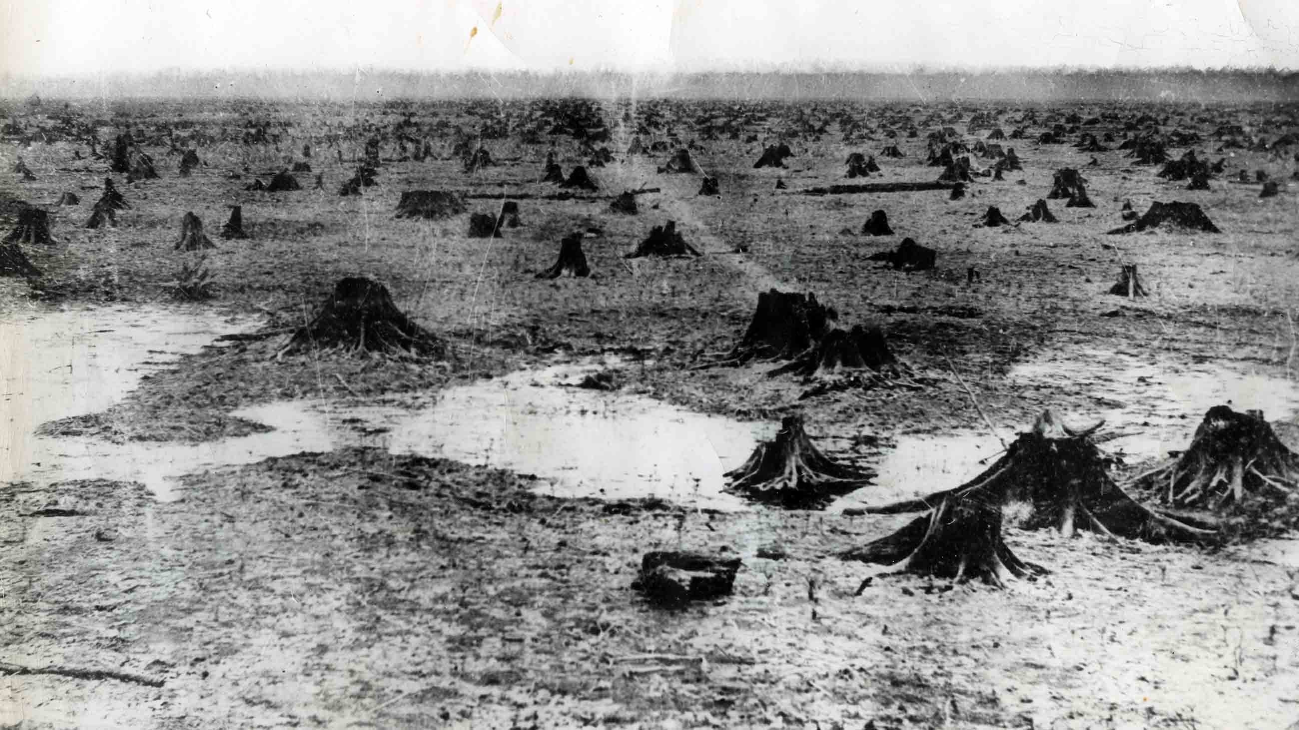
The former Black Swamp was soon crossed with hundreds of ditches. Yet even this was not enough to keep farm fields drained and productive.
To survive, farms in the region needed underdrainage: a series of channels laid beneath a field that would carry excess water to the nearest ditch. The best way of doing this was with drainage tiles, short pieces of ceramic pipe, which laid end to end in a furrow, then covered over with soil, could function for many years. Some enterprising soul tested the abundant clay that lay a foot or two beneath the soil of the Black Swamp, and found that it made excellent tiles.
By 1880, more than 50 tile factories operated in northwest Ohio, and the Black Swamp was dismembered and used to feed an accelerating and diversifying cycle of human industry. The great wetland trees — ash, elm, oak, sycamore — were felled and used to build houses, make furniture, and power the railroads that sprouted up across Ohio. In the 1860s, Ohio’s railways consumed one million cords of wood each year as fuel, and an unknown quantity for ties. The discovery of underdrainage created a growing demand for tile. All this drove an orgy of forest clearing and land draining which in the course of five decades, from 1870 to 1920, completely erased the Black Swamp. A wilderness went up in the smoke from railroad engines, and flowed in drainage ditches down to the Maumee and Sandusky, which began to run murky and lost their once-bountiful populations of fish.
Among the descendants of the settlers who conquered the Black Swamp, drainage is viewed as sacred, while wetland restoration borders on the profane. In terms of water quality, a prime place to create wetlands would be where they intercept the flow of polluted water in farm ditches. That could cause water to back up and flood the fields, however, and it is forbidden under Ohio’s ditch laws, which have changed little since 1859.
“In this area of the world, drainage is the prime concern,” explains Swartz. “If you don’t let our water get away you are essentially making our land unproductive. That just can’t happen, unless you want a lot of landowners just to give up on the potential value of their ground.”
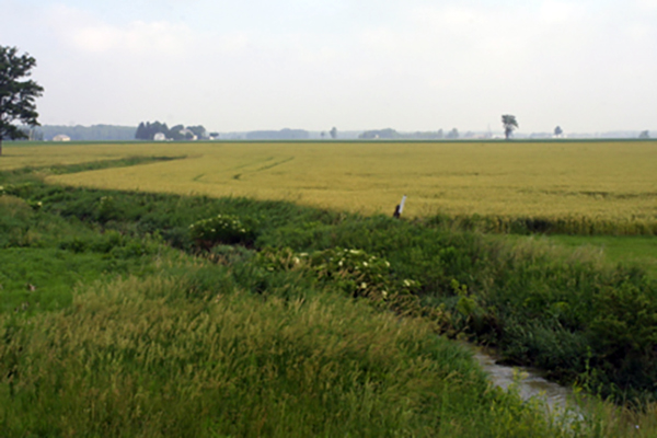
Agricultural fields extend from Benton Ridge, Ohio, at the southern edge of the former swamp. Generations of farmers conquered the marshland with networks of drainage ditches like the one seen here. Those ditches are aggressively maintained.
Visual: Steve Baskauf/Wikimedia/CC
Jim Moyer, the engineer for Sandusky County, has spent much of his career designing and maintaining drainage ditches. One of the biggest challenges in his work is the flatness of the landscape. If the fields of the former Black Swamp were significantly uphill from Lake Erie, he notes, it would be easier to build wetlands into the ditch system without disrupting it. But Moyer has also boated through the bright green algal blooms in Erie’s western basin.” I don’t want to swim in it,” he says. “Or eat any fish out of it either. So, I hope we do something.”
And yet, he doesn’t see large-scale wetland restoration as practical part of that solution. “I try to be realistic,” he says. “In our county, agriculture is important. We have corn, soybeans and wheat, but also tomatoes, cucumbers, peppers, cabbage — high-dollar crops. Boy, they cannot tolerate any excess water.”
Lake Erie’s western basin suffers from the same plague that has struck nutrient-enriched waters around the U.S. and the world, including Chesapeake Bay, the Gulf of Mexico, the Baltic Sea, Grand Lake St. Mary’s in Ohio, Lake Winnipeg in Canada, and Lake Taihu in China. Nutrient overload brings on blooms of algae and toxin-producing cyanobacteria. Thick mats of surface growth deprive underwater plants of light, causing them to wither away. As algal cells die off, they sink to the bottom, where microbes decompose their remains, using up oxygen in the process. The result is a dead zone, an expanse of water so depleted of oxygen that no fish can survive.


The syndrome, known to scientists as eutrophication, first struck Lake Erie in the 1960s — less as a result of agriculture than wanton dumping of city sewage and industrial waste. High counts of coliform bacteria forced beaches to close. Populations of game fish that thrive in clean water, like walleye and bass, dwindled away. After the federal Clean Water Act was signed into law in 1972, new sewage treatment plants were built and old ones upgraded. Phosphate-based detergents, which once contributed 50 percent of the phosphorus pollution in the lake, were banned. During the 1980s and early 1990s, Lake Erie experienced a revival. The waters cleared, fish populations rebounded, and algal blooms faded away.
It was only a matter of time before they returned with a vengeance. The clean-up efforts of the 1970s and 80s led to a dramatic decline in pollution from sewage plants and other point sources. The problem of nonpoint pollution — carried in runoff from farm fields and city streets — has proven much harder to tackle.
As a graduate student in the 1970s, Mitsch ran sewage from a Florida trailer park through a native cypress swamp. He and his fellow researchers demonstrated that the wetland acted as an efficient natural filter, absorbing pathogenic bacteria, organic matter, nitrogen and phosphorus. At the time, researchers in Michigan were showing that peat bogs could serve the same function. Mitsch’s blue-gray eyes gleam behind his metal-rimmed glasses as he remembers that era. “When we discovered this ecosystem service, that’s what they call them now, of wetlands cleaning up water, all of a sudden, the interest in them exploded,” he says. Conservationists began to argue that wetlands should be protected because they act as nature’s kidneys.
Mitsch’s textbook includes a map of the original Black Swamp. He sees it as an important example of a landscape transformed, to the point where few remember it was ever a wetland. It’s a pattern that’s played out more than once in American history: the nation’s most productive farming areas are converted wetlands. Much of the Midwestern Corn Belt was wet prairie. California’s Central Valley was a vast tule marsh. The sugar fields of south Florida were a mix of cypress swamp and sawgrass wetland.
After settlers cleared the Black Swamp of its trees and drained it, they found themselves in possession of some of the most productive farmland on the planet. Over time, farming depleted the soil of nitrogen and phosphorus, elements key to plant growth. So farmers added manure, and later, synthetic fertilizer. Some of the nutrients were taken up by crops. Much washed down to the ditches, into the Maumee and Sandusky rivers, and on to Lake Erie.
Today, farmers in the former swamp continue to lay more lines of drain tile, spaced closer together. The clay pipes placed by their ancestors have broken; the modern version consists of plastic tubing that can be purchased by the spool.
Rainwater that percolates through the soil of farm fields and into the tile drains dissolves phosphorus. Conventional wisdom once held that phosphorus ran off of agricultural land only in particulate form, attached to grains of sediment. Particulate phosphorus tends to settle out of the water column and remain, for the most part, out of reach for nutrient-hungry algae. Soluble phosphorus, known in the lingo of water pollution as dissolved reactive phosphorus, or DRP, is 100 percent bioavailable.
In the mid-1990s, levels of DRP began to climb in the tributaries of Lake Erie. DRP fuels blooms of Microcystis and other kinds of cyanobacteria that have become an annual blight in Lake Erie.
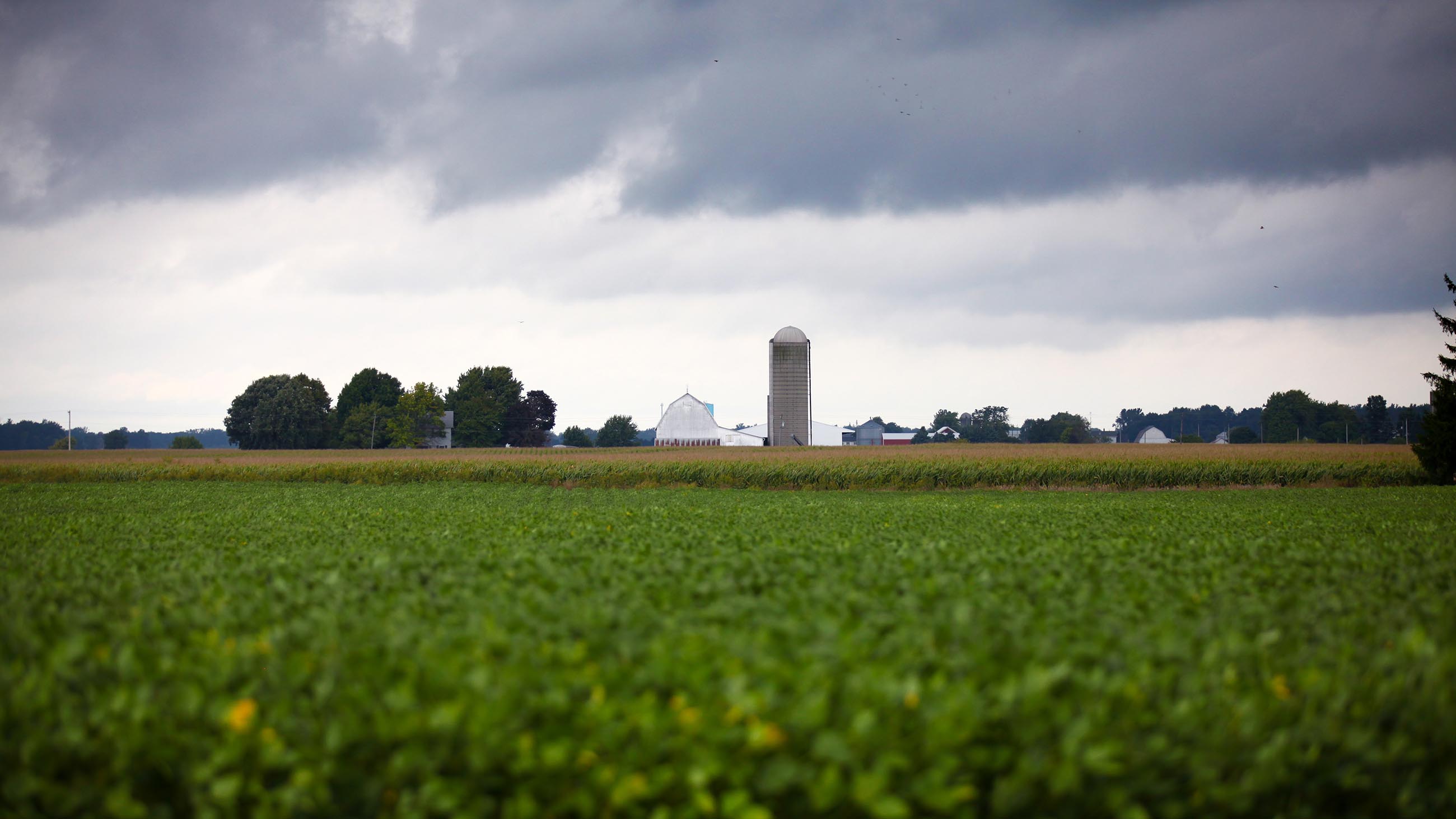
The rise in DRP was triggered by a series of changes in farm management. Instead of rotating their fields between a number of crops, including hay, wheat, and rye, farmers focused on highly fertilizer-dependent corn and soybeans. Subsidies for ethanol production drove yet more planting of corn. Many northwest Ohio farmers adopted no-till agriculture, in which seeds are planted through the stubble of the previous year’s crop, without plowing. No-till decreases erosion and improves the health of the microbial communities that build soil. It also can mean that fertilizer is broadcast on the surface of the ground, where it is easily dissolved and carried off by storm waters. Increasingly, however, farmers are injecting fertilizer into the ground, rather than spreading it on top of soil, mitigating the problem.
In 1995, the first major bloom of Microcystis struck the western basin, fueled by nutrient-rich farm runoff flowing out of the Maumee. The river that once ran clear through the northern reaches of the Great Black Swamp now carries an overdose of phosphorus and nitrogen to the lake during wet springs, triggering Microcystis blooms in the following summers.
If you replace a swamp with high-fertilization agriculture, Mitsch says, “you’re going to screw up something downstream.”
Lake Erie’s most intense bloom to date occurred in the summer of 2015, after heavy rains. Climate forecasts predict increasing rainfall and rising water temperatures in the lake, a pattern likely to favor larger, more intense blooms of Microcystis. But even if reviving parts of the Great Black Swamp makes good ecological sense, it remains a tough sell in an area devoted to food production.
“[Mitsch] may be right in concept,” says Ken Krieger, Director Emeritus of the National Center for Water Quality Research at Heidelberg University in Tiffin, Ohio. But, he explains, “it’s very unlikely that politically and socially the climate will ever be right to take land away from farming, industry, urban areas,” and turn it back to wetlands.
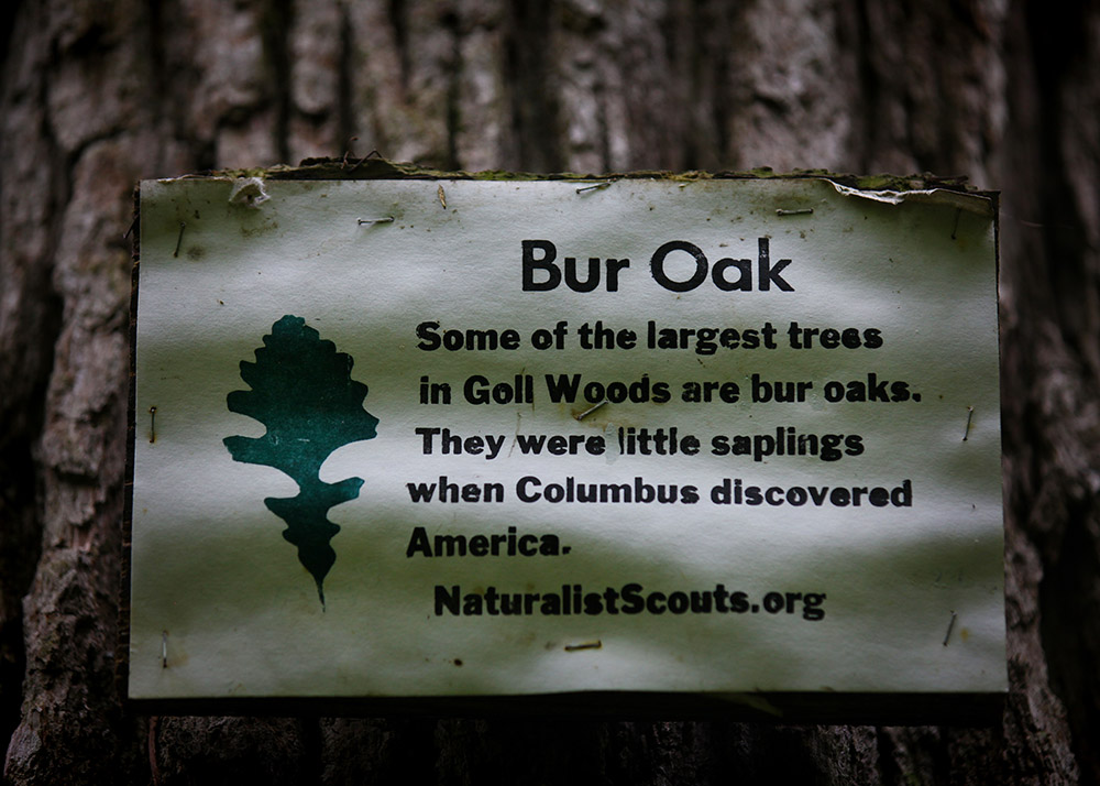
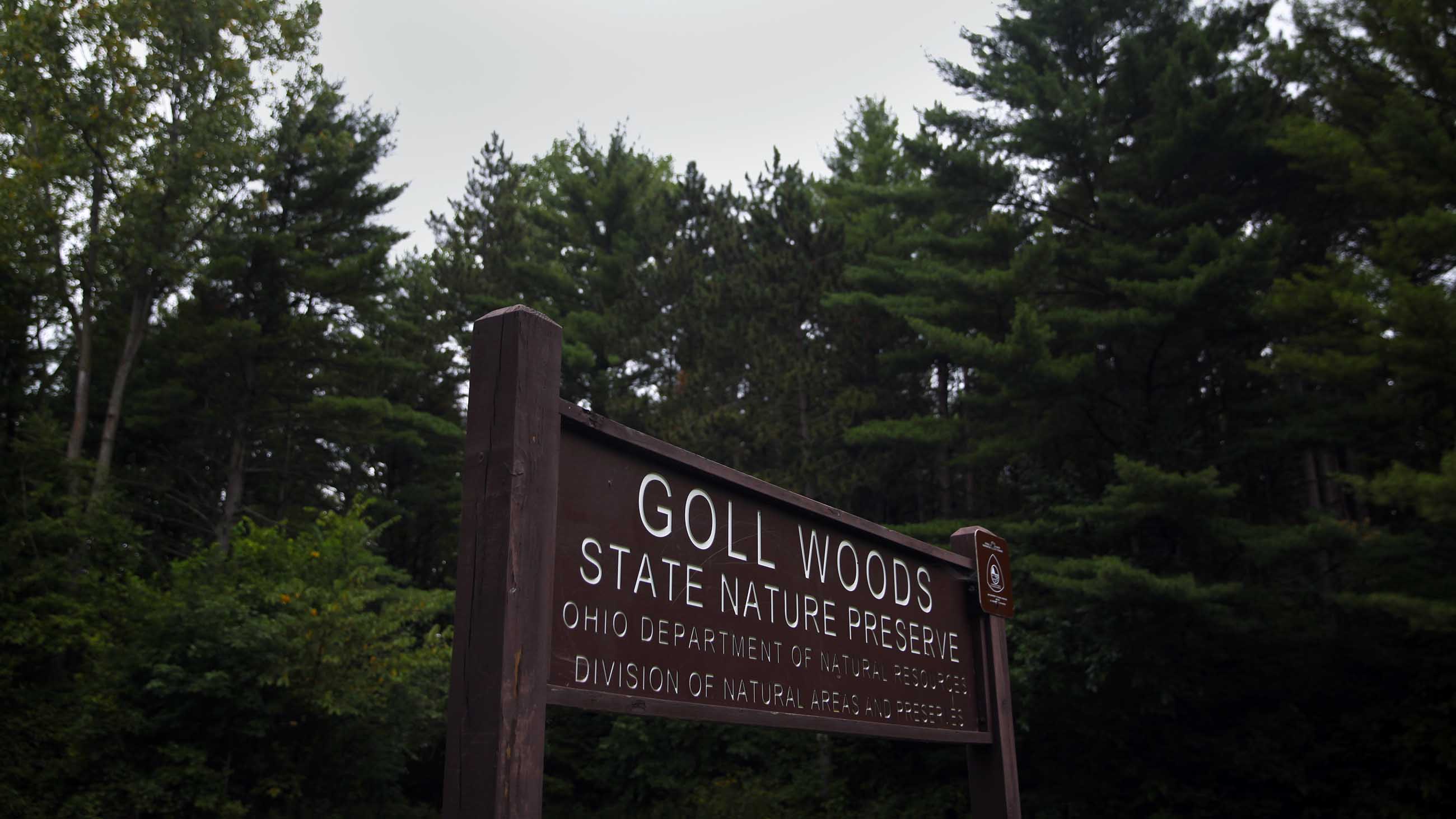
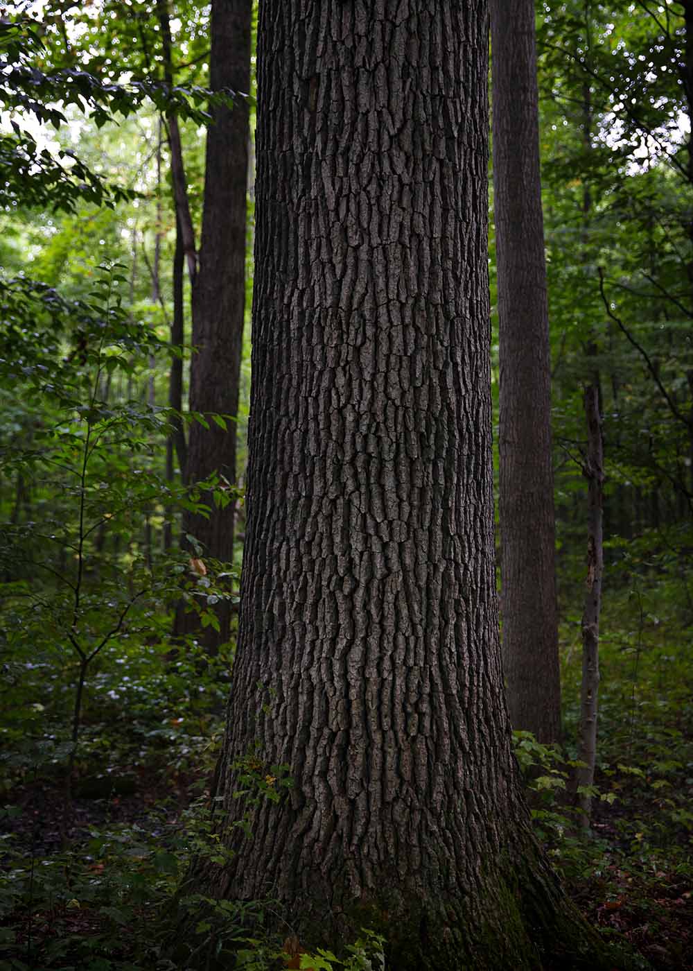
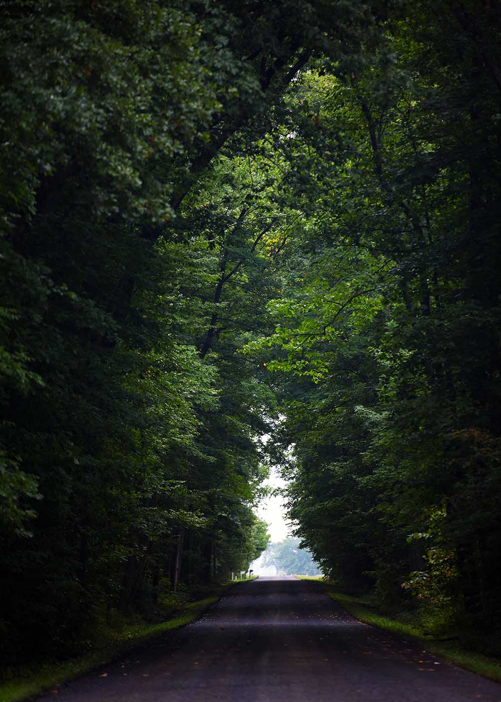
When I went searching for surviving traces of the Black Swamp, Mitsch sent me to Goll Woods Nature Preserve. An island of forest that juts from a sea of farm fields in Fulton County, Ohio, the preserve holds some of the last old-growth trees that grew in the original swamp. Centuries-old bur oaks and sycamores stand like the abandoned pillars of a long-vanquished kingdom. Their massive trunks run straight toward the sky, supporting whorls of leafy branches that hang ninety feet up in the air. Standing in the heart of Goll Woods, immersed in the aroma of dry mud and fallen leaves, it’s easy to conjure the wild past. An expanse of ancient trees stretched for a million wet acres, interrupted only by stands of tall marsh grass. The only residents were deer, elk, wolf, cougar, badger, beaver, bear, muskrat, and an astounding abundance of waterfowl.
Today Goll Woods stands amid endless soybean and corn fields, a ghostly remnant of a former wilderness.
A series of U.S. Department of Agriculture programs devoted to controlling nutrient pollution in Lake Erie’s western basin supports small wetland restoration projects. The programs allow the government to rent fields that are converted to marsh, and to pay landowners rates that can make at least marginal, flood-prone land more profitable than struggling to grow a crop. Farmers who sign up often hear complaints from neighbors who fear any wetland will cause water to back up and flood their crops, or who simply can’t abide the untamed look of wetland plants. And while there is a need for these projects in areas with more productive farmland, the loss of income for farmers there would be substantial.
We are putting a lot of wetlands in,” says Steve Davis, a watershed specialist with the USDA Natural Resources Conservation Service. “Not near as many as we would want to, or as we could, or even as we have funding for.” Most of the landowners that accept the idea are duck hunters, motivated to provide habitat on their property.
Brothers Christian and Peter Lenhart co-own a farm near a short ride south of Goll Woods, near the town of Defiance, that’s been in the family since it was first homesteaded around 1850. When Chris, a water resources scientist at the University of Minnesota, first brought up the idea of restoring a marsh on part of the land, local agricultural officials tried to talk him out of it.
“Ohio is much more anti-wetland than the rest of the Midwest,” notes Chris, who works with Minnesota farmers to develop wetlands designed to filter agricultural runoff. “Talk to people about building a wetland in [Defiance County], and they kind of think you’re crazy,” he says. For him, this attitude goes beyond rationality. It’s tied to the communal memory of people dying of malaria in the Black Swamp.
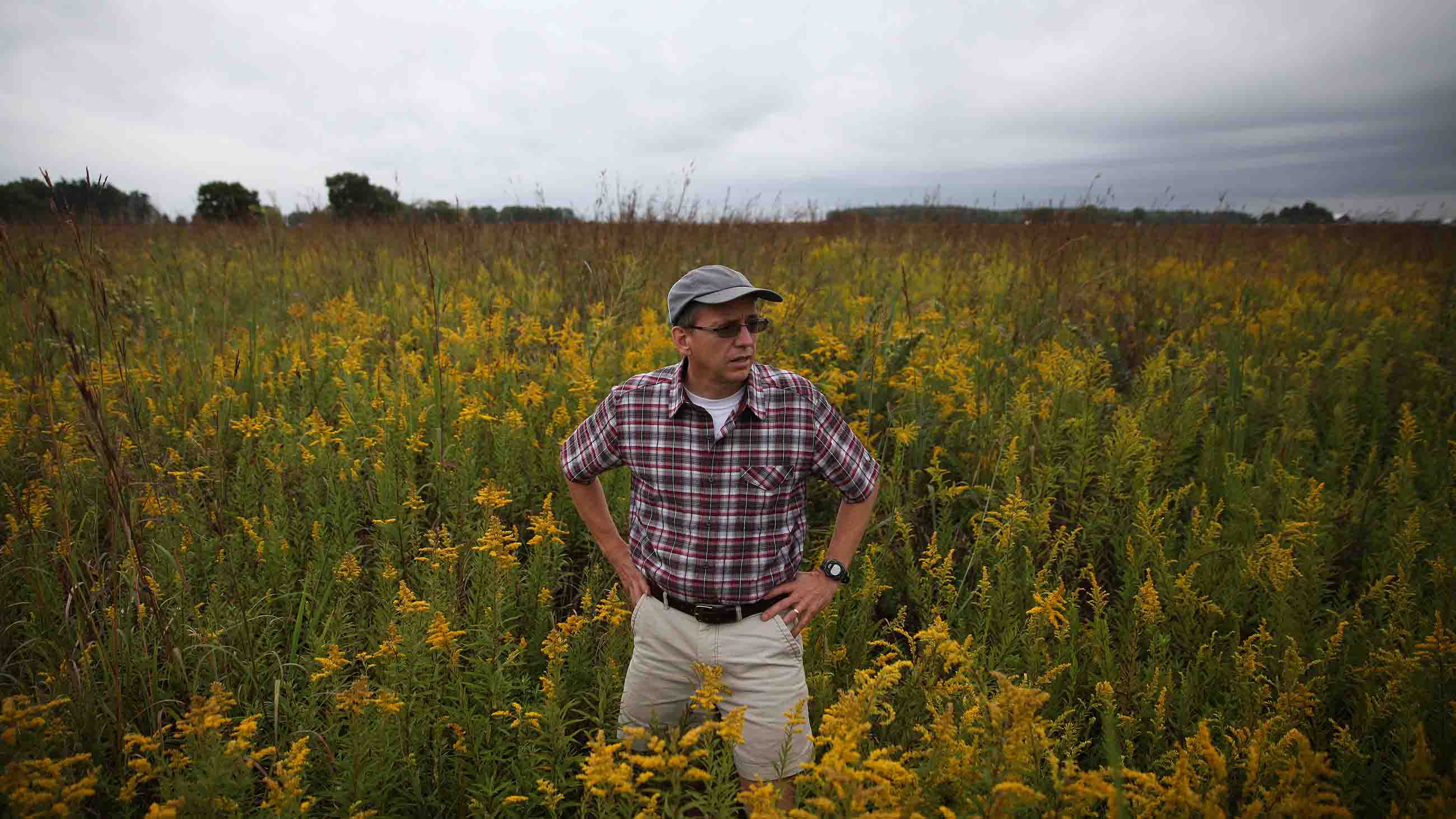
Pete, a physician in Defiance, has grown passionate about both native plants and wetlands. To create the seasonal marsh that now thrives on the Lenhart farm’s back 40, he and his daughters hand-collected seeds of rare native plants. Walking there on a sunny July afternoon, Pete runs his hand lovingly over the bright yellow blossoms of black-eyed Susan, the curling purple petals of bergamot, the bunched seed heads of Ohio spiderwort. The sedges he planted flourish on the wetland’s floor, which goes dry in summer.
In spring, this ground lies beneath a sheet of water, and attracts an abundance of dabbling ducks — blue-winged teal, northern shovelers, mallards. During their long migration north to breeding grounds in Canada, the birds drop down to rest on the Lenharts’ wetland, a rare oasis of natural water among the drained fields. The northern harrier, a marsh-adapted hawk now endangered in Ohio, has been seen hunting here. In spring the neighbors complain of the noise from thousands of courting frogs.
The Lenhart wetland clearly works as habitat, but in terms of improving the quality of water running down to the Maumee, it’s not doing much. The family could not build a wetland that intercepted the flow of polluted runoff in the ditch, because the Defiance County Soil and Water Conservation District rejected it. “They’re very autocratic, very authoritarian” says Pete, who says drainage officials are “kind of Nazis. The ditch people are just crazy.”
The district recently came in and rehabbed the ditch that passes through the farm, over the objections of the Lenharts and other local property owners. Before the district improvements, Pete could count around 50 species of plants growing in the ditch — many of them natives. Now the area is dominated by a single species: fescue grass.
There’s a reason for that, says Jason Roehrig, Administrator for the Defiance Soil and Water Conservation District. He points out that drainage ditches are man-made channels designed to keep water off the fields, and by law, the ditches under the district’s purview must be maintained in perpetuity — not as habitat for native plants but as stable conduits that can handle intense flow in times of heavy rain. Fescue is not a native species, but Roehrig notes that it “provides a durable, dense sod that resists erosion … and is relatively quick and easy to establish.”
By contrast, native plants are much slower to take hold.
Ohio’s ditch regulations entitle every landowner to the fastest, most efficient drainage — and they make little allowance for other priorities. “These fields that you see around here, it’s not like it’s landscape,” Pete says as he gestures at the vista of drained fields that stretches to the horizon. “These fields are machines.”
“The ditch commissions are in direct conflict with trying to get clean water into Lake Erie,” he adds.

Most farmers in the region acknowledge the need to limit nutrient runoff. The federal Natural Resources Conservation Service has a three-year, $41 million program available to help farmers implement changes aimed at stopping nutrient pollution in western Lake Erie. The money can be used to fund a range of strategies, from high-tech management of fertilizer application to drainage water management to planting buffer strips of grass or trees at the edge of ditches. Buffer strips have been widely adopted in the former Black Swamp. They are effective in decreasing erosion, and in some places can reduce the amount of total phosphorus running off a field by about half. Tile drains running beneath the soil surface continue to carry soluble phosphorus off the land, however.
A recent analysis from the University of Michigan suggests that under the current levels of use, buffer strips and other best management practices aimed at minimizing nutrient runoff won’t be enough to rescue Lake Erie. The BMPs do help, but a relatively small proportion of farmers are using them.
The study found that taking 50 percent of cropland out of production and letting switchgrass grow there would bring phosphorus loads in Lake Erie down by 40 percent, the goal set in an international agreement between Canada and the U.S. The authors acknowledge that’s never going to happen. They included that example in their study to underscore the scale of change that will be needed to address the problem.
Mitsch agrees that widespread eutrophication demands a large-scale solution, but he doesn’t believe that BMPs alone can solve the problem. He points to the infamous dead zone in the northern Gulf of Mexico, which is fueled by nutrients that run off of farms in the Mississippi basin. In the 1990s, Mitsch was part of a committee that studied solutions to that problem, and concluded that best management practices were part of the answer, along with building wetlands back into the watershed. Twenty years later, only a few scattered patches of wetland have been restored, and little progress has been made in lowering nutrient loads or healing the dead zone.
Chris Lenhart has begun studying nutrient retention in the family’s marsh and two other nearby wetland projects. While his wetland is removing a fair amount of nitrogen and phosphorus, “it’s not treating any additional farmland.” To really treat the problem, he says, you need wetlands that collect runoff from hundreds of thousands of acres.
There is only one place on the planet where constructed wetlands are successfully treating farm runoff on that scale: the Everglades Agricultural Area of south Florida.
Once part of the sawgrass marsh and cypress forest that made up the original Everglades, the land later designated as the EAA was drained in the early 1900s, when canals were dug to divert Lake Okeechobee’s waters to Florida’s coasts. As in the Black Swamp, drainage uncovered fertile wetland soils. Florida’s canals were excavated using the Buckeye Traction Ditcher, designed in the 1880s by James Hill, a young man who grew up near Fremont on the eastern edge of the Black Swamp. Having experienced the back-breaking labor of digging ditches, he invented a steam-driven machine that could lay trench faster than a crew of 15 experienced men. The Buckeye Ditcher brought the drainage expertise of Ohio to the wetlands of Florida, and helped to open up 700,000 acres of wilderness to farming.
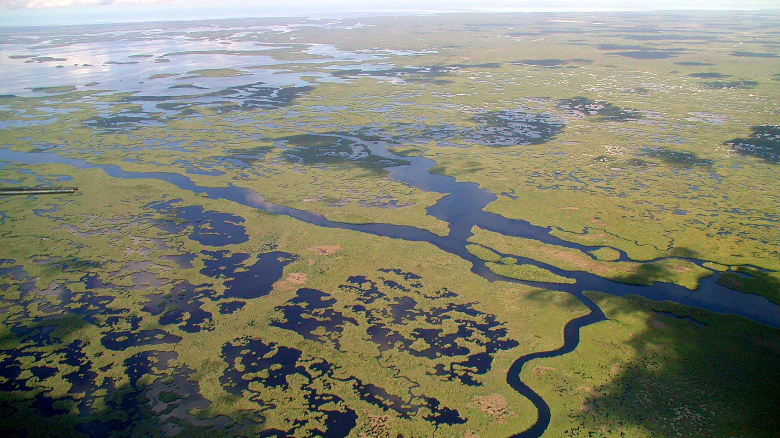
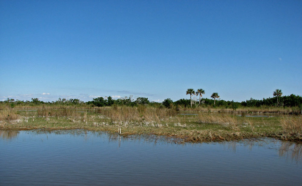
Farm runoff degraded the surviving Everglades wetlands, which lie south of the EAA. Cattail, a wetland plant adapted to phosphorus-rich waters, displaced the native sawgrass. Herons and egrets find little prey in thick stands of cattail, and the plant’s rapid expansion contributed to a 90 percent decline in the abundance of wading birds in the Everglades.
By the 1980s, conservationists were demanding that Everglades National Park be protected from water pollution. In 1988, the federal government sued two Florida environmental agencies for failing to enforce the state’s own water quality standards. Three years into the litigation, Governor Lawton Chiles walked into federal court in Miami and announced the state’s surrender. “We want to plead that the water is dirty,” he said. “We want the water to be clean, and the question is how can we get it the quickest.”
After more than two years of intense negotiations, the U.S. Department of Justice and the state of Florida reached a settlement agreement. The path to clean water in the Everglades would involve converting tens of thousands of acres of farmland to constructed wetlands, designed and managed to filter out phosphorus. In addition, farmers would be required to use best management practices to limit the concentrations of phosphorus in runoff.
The first pilot treatment wetland was created on 3,815 acres of state-owned land. Scientists working on the project demonstrated that the managed marsh could remove nearly 75 percent of the incoming phosphorus load. Over time, cattails and other aquatic plants died and partially decomposed on the bottom, building a new layer of organic peat that acts as long-term phosphorus storage.
The lessons of the first pilot marsh have been applied to a series of scaled-up constructed wetlands built at the southern edge of the EAA, called Stormwater Treatment Areas by the South Florida Water Management District. The STAs now cover more than 57,000 acres.
According to Gary Goforth, an environmental engineer who worked on development and operation of the large-scale wetlands for over two decades, the STAs do an outstanding job of filtering phosphorus. When the first STAs were built in 1997, the goal was to take runoff water carrying about 200 parts per billion phosphorus and reduce the load to 50 parts per billion.
Nowadays, the STA effluents are well below that figure, often containing less than 20 parts per billion phosphorus. Walk one of the dikes that surround the wetland cells, and you’ll find yourself surrounded with wood storks, roseate spoonbills, alligators, and rare birds like the Everglades snail kite and black-necked stilt, both endangered species that nest in the STAs.The positive performance of the STAs has been possible in part because farmers in the EAA adopted a range of best management practices, including limiting the amount of water that they can pump from their fields and carefully measuring soil nutrient levels, so that fertilizer is applied only where it’s needed.
The Everglades farming community had to be drawn into the process against its collective will. Goforth, who served as an expert witness during a long series of court cases involving Everglades restoration, recalls farmers testifying that a required 25 percent reduction in runoff phosphorus loads would put them out of business. Today, using an evolving array of BMPs, phosphorus loads in waters entering the STA system have been reduced significantly — by an average of about 50 percent in recent years.
The engineers who built the STAs and continue to monitor their function have created an extensive knowledge base on how to design and operate large treatment wetlands. Circumstances would, of course, be different in northwest Ohio, where wetlands might freeze and most plant growth halts during winter. The system should be easily adapted, however.
Mitsch has been tracking two small restored wetlands he built on the Ohio State campus in 1994. They are reliably retaining phosphorus, carbon and nitrogen. Robert Kadlec, an emeritus professor at the University of Michigan who has consulted on the design and operation of the STAs since their inception, has also demonstrated that both natural and constructed wetlands effectively absorb excess nutrients in the Midwest. What we need in the western Lake Erie watershed, says Mitsch, “is something on the scale of the STAs in Florida.”
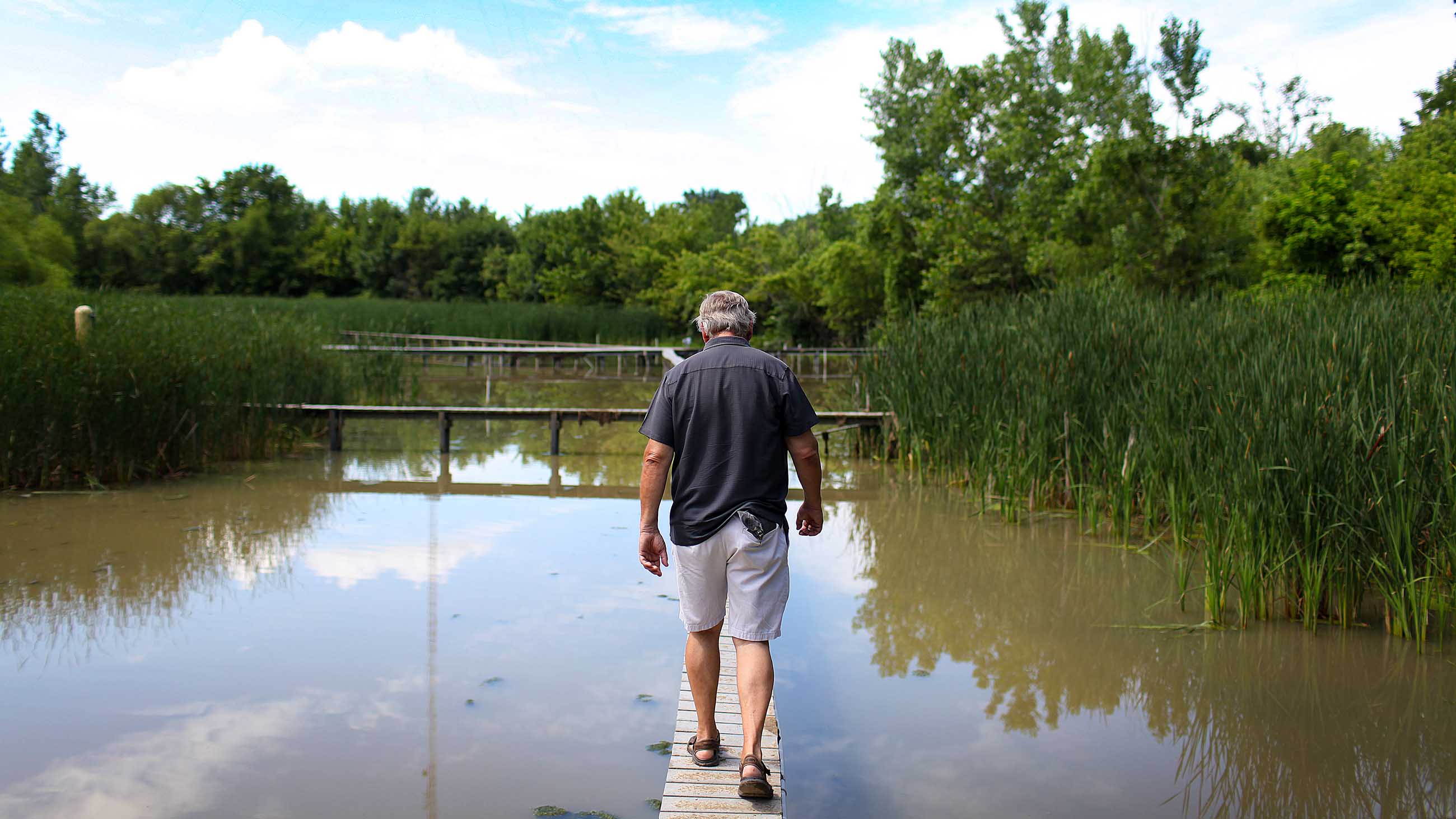
The major obstacles, whether in Ohio or Florida, are social and political. “Agriculture is a very strong lobby, in any state,” says Goforth. It took the federal lawsuit to bring the farmers to the table. They realized it wasn’t just business as usual.
Farmers in the EAA have adapted to work with the water district to reduce phosphorus loads going into the Everglades. Keith Wedgworth runs a farm that’s been in his family since the 1930s. “We bought into the STAs, and they’ve done what they were supposed to,” he says. Due to an array of best management practices, Wedgworth says the runoff leaving his farm is cleaner than the water that flows in from Lake Okeechobee.
After Mitsch retired from teaching at Ohio State, he returned to Florida. He is now director of the Everglades Wetland Research Park at Florida Gulf Coast University — living and working in America’s wetland mecca. The struggle to create the STAs there was resolved when the state was able to buy land from willing sellers. Wetland peat makes rich soil, but when dried out and exposed to the air it can oxidize, vanishing in a slow, invisible burn. At the southern edge of the EAA, farmers were going out of business because the layer of soil above the limestone bedrock had worn too thin. They were willing to move on.
Still, the controversy has recently revived, because it turns out 57,000 acres of treatment wetlands may not be enough. Heavy rains struck Florida in the winter of 2015-16, during what is usually the region’s dry season. With the Everglades flooded and insufficient treatment and storage capacity south of Lake Okeechobee, the rising water had to be sent down the canals that lead to the Atlantic and Gulf coasts. The storm waters carried an intense pulse of nutrients to estuaries, triggering a guacamole-thick bloom of cyanobacteria that continues to plague the region months later. Mitsch has suggested that the only solution is to buy out at least 100,000 additional acres of farmland to create more STAs.
If that is ever to happen, the question will be the same one Swartz poses in Ohio: Who will give up their ground? Wedgworth feels that farmers in the EAA, south of Lake Okeechobee, are already doing their part. “We’re part of the solution,” he says. “It’s in my interest to be the best steward of the land possible, so I’m able to pass it down.”
Everglades National Park covers 1.5 million acres, and is known worldwide as a wilderness gem. The area is listed as a Wetland of International Importance under the Ramsar Convention, a pact aimed at protecting vital wetland habitats worldwide. The push for a global wetlands agreement began in the 1960s, fueled by concerns over vanishing habitat for migratory waterbirds — but Ramsar Convention criteria have evolved to recognize other wetland ecosystem services, including water quality protection.
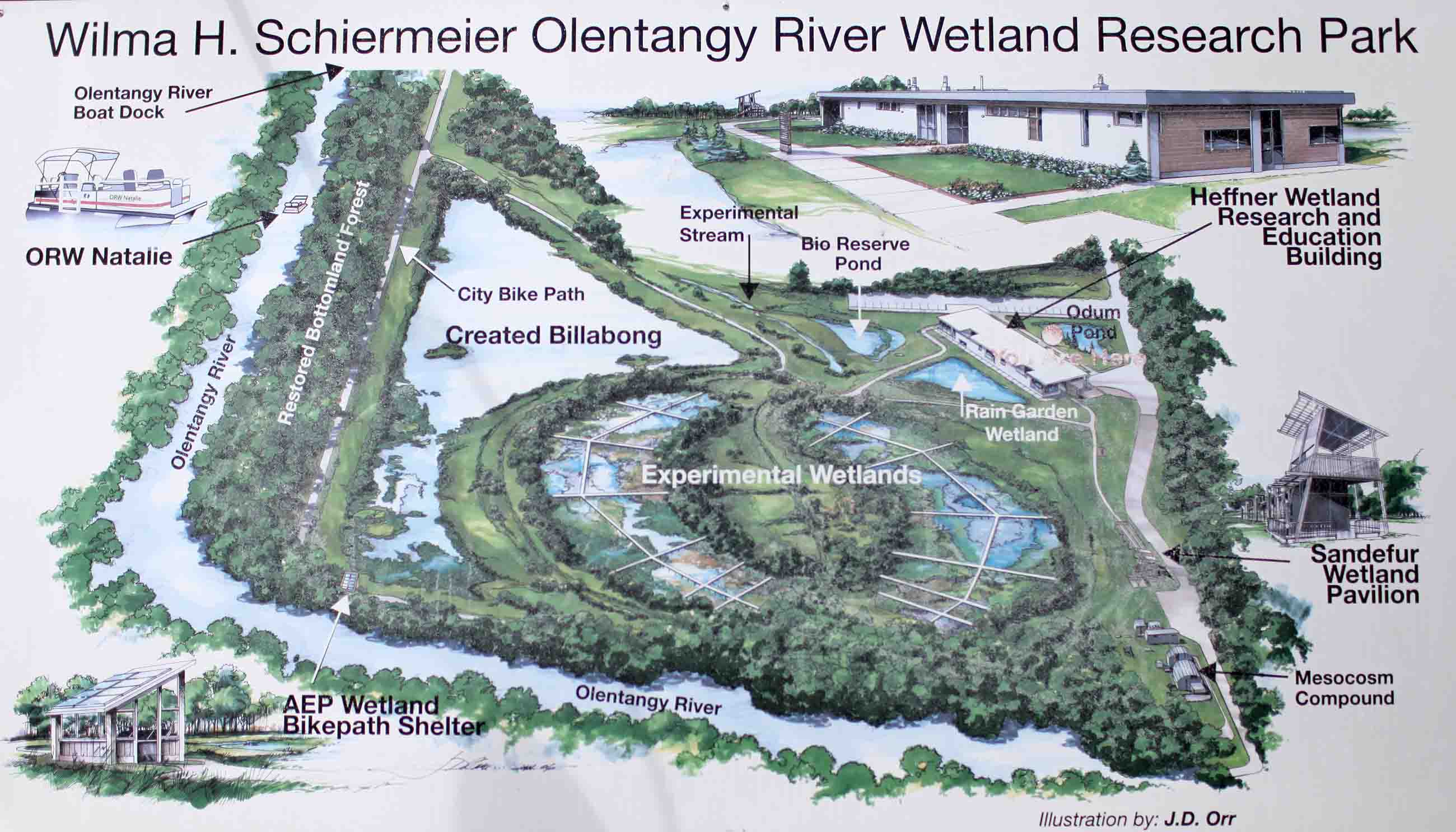
Conservation groups in Ohio, meanwhile, have focused on restoring native wetland plants and providing waterfowl habitat. Altering flows to allow polluted water to slow down, spread out, and be filtered through aquatic vegetation is rarely considered, Mitsch says. Indeed, the only Ramsar site in Ohio is the Olentangy River Wetland Research Park, which takes up 50 acres on the Ohio State University campus in Columbus. Mitsch drove the creation of the wetland complex beginning in 1994, when he built his two small, experimental wetlands fed with water pumped from the Olentangy.
But other experimental sites are taking shape.
Tucked away in tall grass, a mile or so from the popular lakefront beach at Maumee Bay State Park near Toledo, lie three rectangular wetland cells. Designed by Daryl Dwyer, an ecology professor at the University of Toledo, the wetlands exemplify both the potential of constructed wetlands for cleaning polluted runoff and the daunting obstacles to building such systems in Ohio.
For years, the state park’s beach had to be closed to swimmers after heavy rains. Wolf Creek, a channelized ditch that runs down to the park and empties near the beach, was tainted with coliform bacteria from leaking septic tanks and manured fields. The EPA offered funding for a project that could mitigate the bacterial contamination, and Dwyer’s idea of constructed wetlands was awarded a grant.
The bottom of each cell is lined with limestone, which adsorbs phosphorus. The thick growth of wetland plants slows the flow of water, filters out sediment and coliform bacteria, and takes up nutrients. Ditch water pumped through the wetlands sheds about 50 percent of its phosphorus and 98 percent of its E. coli bacteria. “The system works exceptionally well, better than we thought it might,” says Dwyer.
Dwyer could not obtain a permit to alter Wolf Creek’s flow, so the three wetland cells were built off to the side of the ditch, and water is pumped through them. Due to an engineering snafu, the wetlands were built only half as big as Dwyer envisioned them. Only 2 to 5 percent of ditch water is treated. Still, water quality at the state park beach has improved, at least in part because leaking septic systems in the Wolf Creek watershed were shut down.
In local news coverage of efforts to reduce agricultural runoff into Lake Erie, Daryl Dwyer, an ecology professor at the University of Toledo, discusses his modest wetlands restoration project.
Dwyer sees the state park project as a successful pilot, proof that more and larger constructed wetlands could make a real difference. His hope is to apply the idea at strategic spots on public parkland, where the flow of phosphorus-rich runoff can be treated beyond the jurisdiction of the drainage districts. The major obstacle, Dwyer says, is a lack of funding, and given that reality, his ambitions for constructed wetlands in the region are more modest compared to Mitsch’s vision.
“I don’t disagree with Mitsch,” he says. “I just don’t think it will ever happen.”
Mitsch thinks otherwise, and remains hard at work, trying to demonstrate that farming and wetlands can coexist. His latest study uses mesocosms — arrays of miniature marshes set up in tubs, which allow him to test the effects of different flow rates and plant communities on a wetlands’ ability to take up nutrients. One test site is near the shore of Buckeye Lake in Ohio, which has been plagued with harmful algal blooms. A second is in south Florida, and Mitsch is seeking funds for a third site on Long Island, New York.
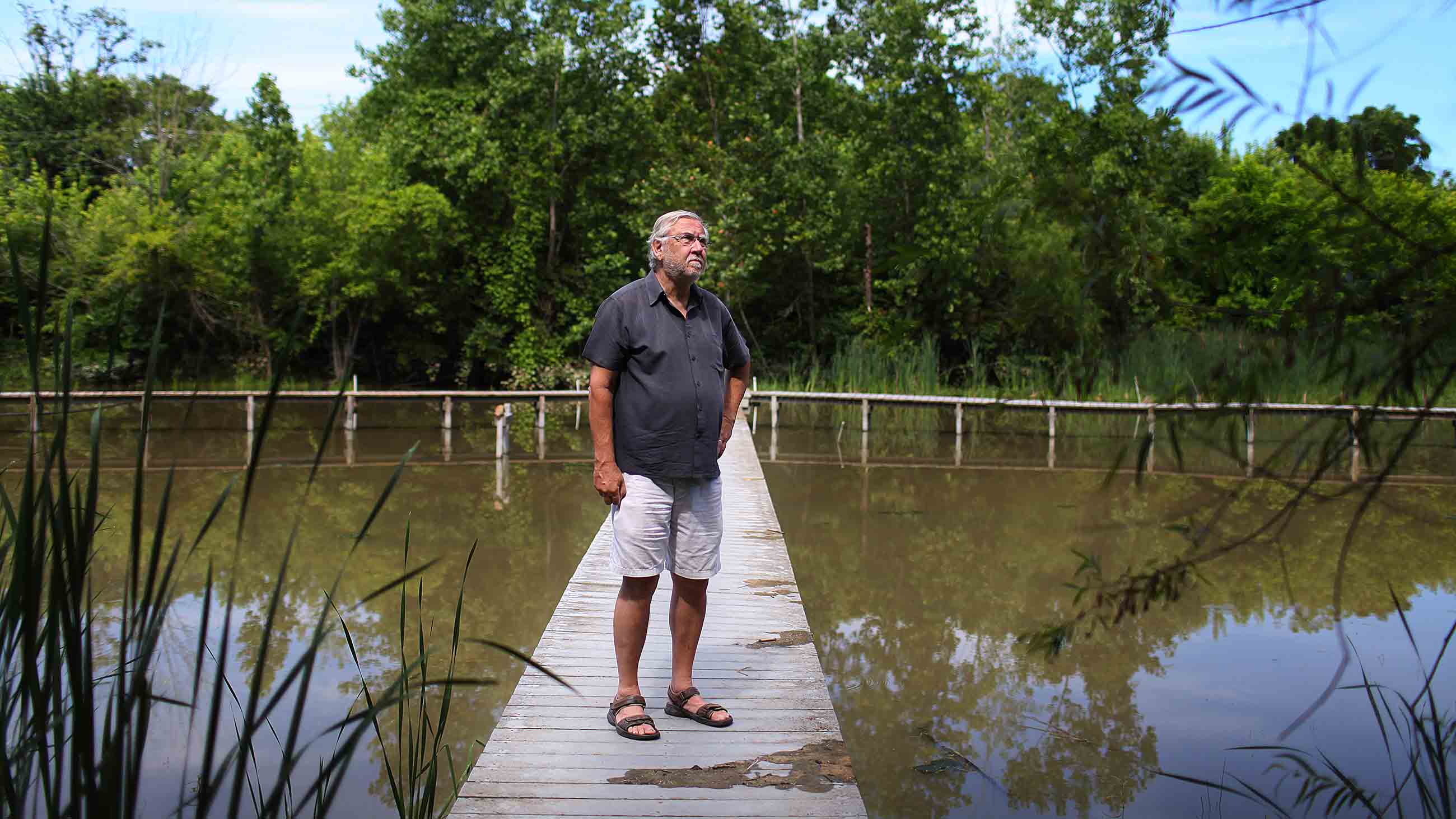
The new project focuses on a way of trapping phosphorus in wetlands and then returning it to agriculture, but Mitsch won’t reveal the details of the plan, which he says are proprietary. He’s confident, however, that it will be applicable to the former Black Swamp. The goal is to merge wetlands with farming, using man-made marshes to capture nutrients that can then be returned to the fields, saving farmers the cost of synthetic fertilizer.
Mitsch was encouraged when he visited Sweden last summer and was shown a system set up to capture the nutrient pollution that has caused harmful algal blooms in the Baltic Sea. He sent me a photograph: a flat green field that might have been in northwest Ohio. What marked the place as foreign was a long strip of tall reeds, sprouting from an artificial wetland that stands between the field’s edge and the drainage ditch. Swedish researchers have suggested that the government should pay farmers based on the amount of nutrients sequestered in their wetlands, a policy that would cast farmers as environmental entrepreneurs.
Mitsch has been thinking big about wetlands for a lifetime. He still hopes to transform the way soggy American landscapes have been managed since settlement times, and to fit wetlands back into the picture. He insists that any real solution will have to be deployed on a grand scale. If we’re not willing to do that, Mitsch says, we should admit we’re willing to accept lakes painted bright green by blooms of toxic cyanobacteria.
“It’s a question of ‘Do you want to solve the problem or not?’” Mitsch says. Voluntary best-management practices, applied or rejected by individual farmers across the watershed, won’t do the job, he says. “It has to be a landscape scale solution.”
Sharon Levy spent a decade working as a field biologist in the woods of Northern California before taking up science writing full time. She is a regular contributor to BioScience and Environmental Health Perspectives, and is at work on the forthcoming book “The Marsh Builders: The Fight for Clean Water, Wetlands and Wildlife.”



Comments are automatically closed one year after article publication. Archived comments are below.
This is an incredibly informative article about the Great Black Swamp/former wetlands of this area and current water quality issues. I’m visiting the area next week (was looking for recreational opportunities when I found this) and wish there were more natural/wetland areas to explore in this state. In addition to improving water quality, restoring wetland/natural areas creates recreational opportunities for birders, visitors, and residents. That adds to the local economy through tourism. It’s a big challenge, but it seems there could be a balance between food production and preservation of natural areas.
Glad to see this activity and recognition of the cause of this very real problem. One not mentioned is that homeowners contribute to the problem by try to maintain perfect lawns their chemical runoff is contributing to the issue. Also golf courses also can help increase the problem. If we are to solve this very real problem we cannot ignore it we must recognize the need for wet land restoration and do it or else the cost will only increase.
The phosphorus issue has more to do with the cities and towns that dump the human waste in the rivers and Lake Erie when it rains more than 3 inches. Stop bashing the farmers that have been farming for years and know how to manage their farms soil nutrients.
Water, a product that mankind cannot do without. The problem with water though is, that too much of it is hoarded, polluted with chemicals on the farm, in industry and the homeplace. It’s really about greed. The Black Swamp was cleared to grown productive farms and the swamp could have been left alone as there was plenty of dry land to have a farm. Water is getting scarce because of man’s greed, just look at all of the homes that have a swimming pool and the billions of automobiles in operation as well as the millions not in operation that have water in their radiators. Water pumping to satisfy the want for a swimming pool and all the water sucked up for cities and counties, it’s no wonder why wetlands dry up and the good they provided, stops.
Does anyone think if we let the ditches grow cattails i them instead of cleaning them out that might filter some of the farmer run off before the water reaches the Portage ,Maumee ,Sandusky rivers or Lake Erie
The information on Maumee Bay State Park/ Wolfe Creek/ and the beach at Maumee Bay State Park are simply incorrect. Originally, and sometimes currently, beach closings at Maumee Bay have been due to ecoli that comes primarily from human sewage. If the author checks the data, about 75% of the reduction of beach closings at Maumee Bay State Park came from the installation of sewers upstream from Wolfe Creek. The original purpose of the wetland project was to reduce the other 25% of ecol. But when the algal blooms began to close the beaches at the park, the focus shifted to phosphorus for the wetland project. Students at UT stated that phosphorus data for testing in Wolfe Creek were very low and that phosphorus from Wolfe Creek was not a problem. As the Maumee Bay wetland project progressed, there has been more and more rhetoric about the constructed wetlands and its phosphorus benefits. The reality is there was little phosphorus to start with and there were many locations where the wetlands could have been constructed that would have captured far more phosphorus. But putting the wetlands in a state park was cheap and convenient. Lastly as to the comment on the relocation of Wolfe Creek, originally Wolfe Creek drained to a preserve known as little Cedar Point. Many supported Wolfe Creek being relocated to its natural flow,but that would not have supported creating a constructed wetlands in Maumee Bay State Park. The recommendation to construct wetlands at parks and other public places only makes sense if the wetlands would actually capture large amounts of phosphorous that can help Lake Erie.
ps The hand with the algae jar was mine and should have been so credited.
With all due respect, Sandy, unless the image was taken by you- which it’s not, because Aaron P. Bernstein took it as a Getty photographer, you released permission to him to use the image thereby transferring all credits to be given to him. The author did credit that the picture was an image of a resident, which I assume is you, therefore a correct description and ultimately, credit, has been given… to ‘your hand’.
I feel there will always be two sides of the story, however I find this article is extremely well-written and anyone really looking for more information and facts into the issue should do their due diligence before forming any solid perceptions of the situation.
Wetlands will always have a love hate relationship with those living around it and the livelihood of the farming community who provide the food we all need to live.